Newton Visual Zoning Comparison
Village Center Zoning 1 and 2 plus MBTA Communities Zoning
Prepared by Richard Rasala r.rasala@gmail.com
Updated June 19 2023
Introduction
The reason for building this web site was to be easily able to visually compare:
- The Newton Village Center Version 1.0 Zoning Maps
- The Newton Village Center Version 2.0 Zoning Maps
- The additional MBTA Communities Zoning Maps
To help compare 1.0 zoning maps with 2.0 zoning maps, a 1.0 map and 2.0 map will be shown together with the 1.0 map above and the 2.0 map below.
This site will use image captures from the relevant Village Center Zoning documents.
Each image is set up so that it links to a stand alone version of itself in a separate tab. This allows you to see a larger version of the image if you wish.
This site will show other relevant images in addition to maps.
After the preparation of this site was begun, the city released a comparison tool:
This tool is extremely valuable since you may zoom into any area of Newton and see exactly which parcels have been zoned in either Version 1.0 or Version 2.0 of Village Centers Zoning.
However, there are three drawbacks with this comparison tool:
- You must toggle between seeing a Version 1.0 zoning map or a Version 2.0 zoning map. There is no way to compare both kinds of map in the same browser window.
- There is no way to save your current location and current zoom level in the comparison tool. Each time that you open the tool, it currently starts in West Newton at a standard zoom level. This means that if you wish to save any map shown in the comparison tool, you must do an image capture to save the map as an image. The process of saving a specific map as an image is not automated.
- The map colors used as the legend in the comparison tool are not the same as the colors used in slides presented at the ZAP meetings. This disagreement is puzzling.
We therefore believe that this site will be of value to the those in the Newton Community who wish to easily examine the differences between Version 1.0 and Version 2.0 of Village Centers Zoning.
This site is a 100% data site. There is no opinion about the zoned areas or the zoning rules.
Contents
Each Contents item below links to the corresponding section on this web page.
- Village Center Zoning documents
- Zoning Map Legends 1.0 vs 2.0
- Visual Comparison of Village Center Zoning Maps 1.0 vs 2.0
- Zoning Specs for Version 2.0
- MBTA Communities Zoning and Maps
Green Line B Branch
Green Line D Branch
Commuter Rail
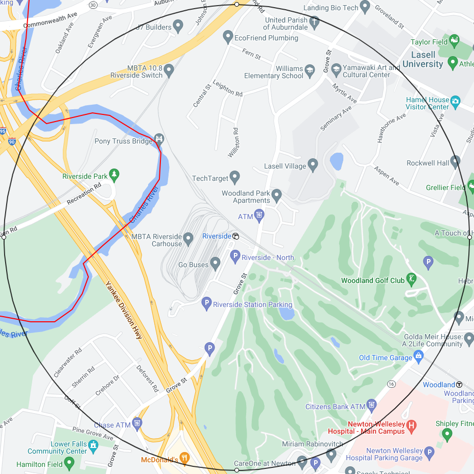
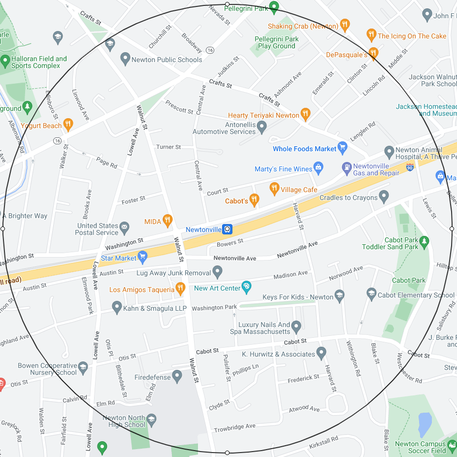
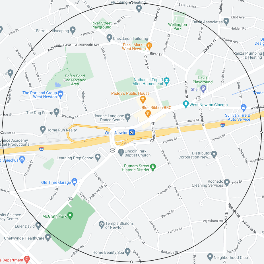
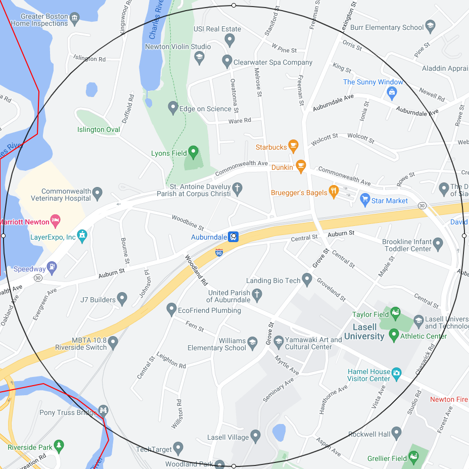
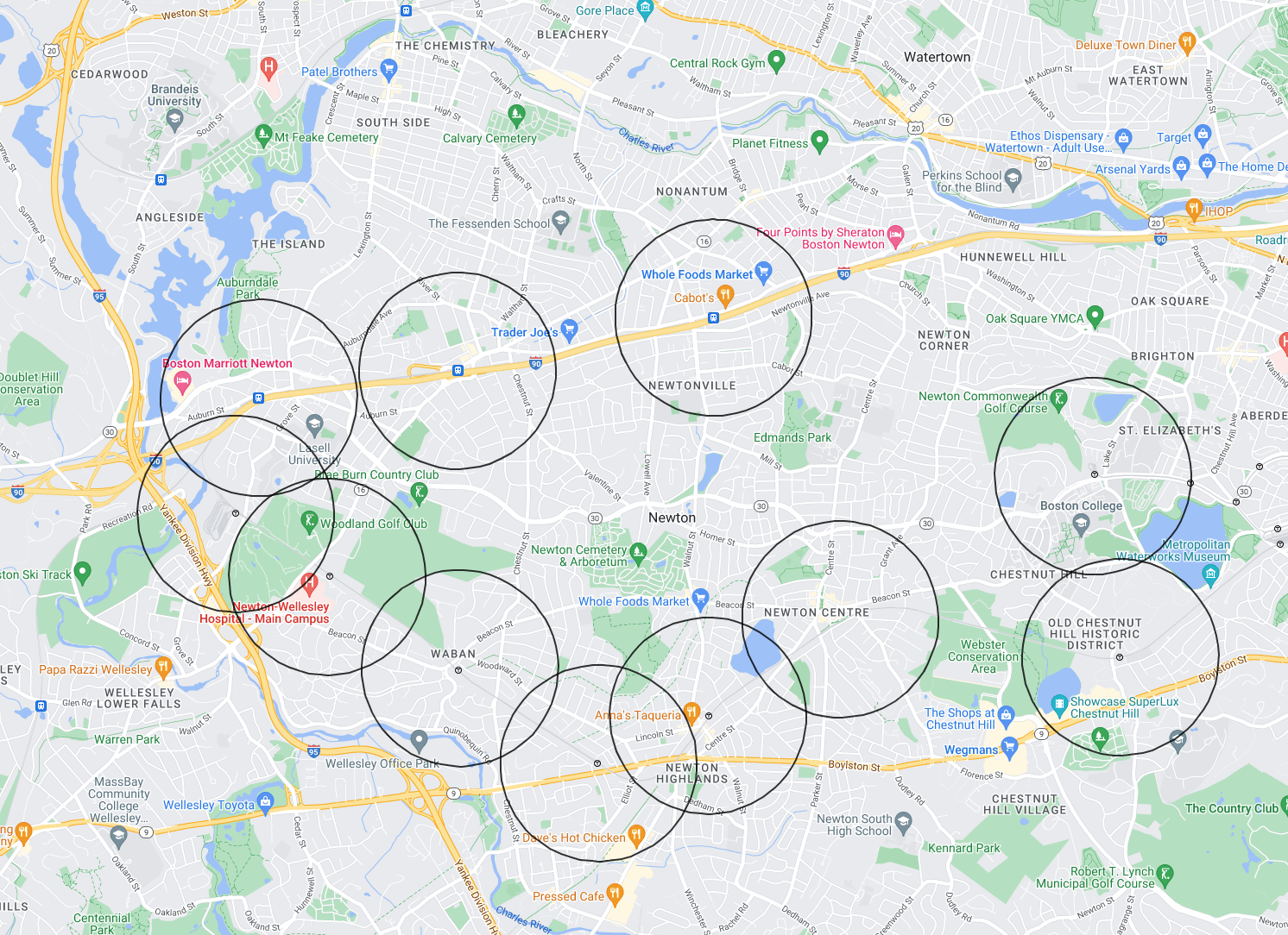
11 Half Mile Circles
Village Center Zoning documents
The Village Center Version 1.0 original slides are at:
The Village Center Version 2.0 original slides are at:
On the site Newton MA Zoning Documents I have collected all zoning materials since January 2020. To find more information about Village Center Zoning, you may search on this site for: “village center”, “vc”, and “mbta”.
Zoning Map Legends 1.0 vs 2.0
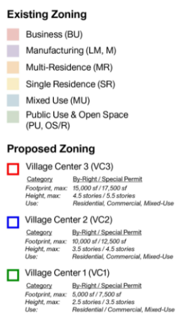
Below is the map legend on a Village Center Zoning Version 1.0 map:
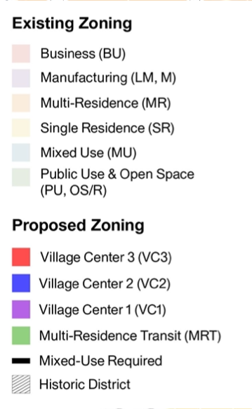
Below is the map legend on a Village Center Zoning Version 2.0 map:
Note 1:
- In version 1.0, there are 3 zones: VC3 (red), VC2 (blue), VC1(green).
- In version 2.0, there are 4 zones: VC3 (red), VC2 (blue), VC1(purple), MRT (light green).
- Although the areas zoned for VC1(green) in version 1.0 are often similar to the areas zoned for MRT (light green) in version 2.0, the zoning specs are different in that MRT zoning is less intense. Therefore, do not confuse the old VC1(green) with the new MRT (light green).
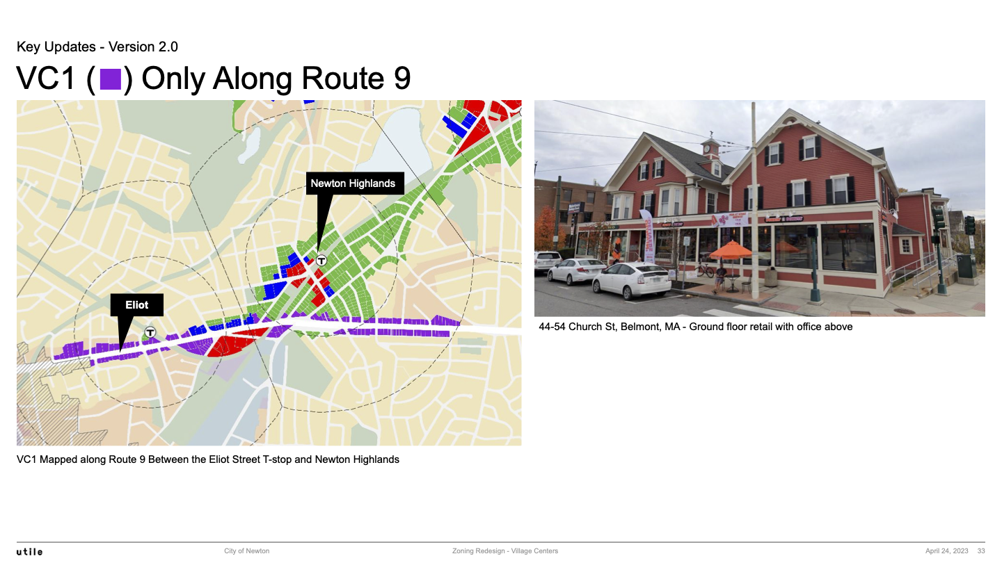
- The version 2.0 VC1(purple) is only used along Route 9.
Note 2: Since the decision was made not to zone a Historic District, such districts are shown using black diagonal lines.
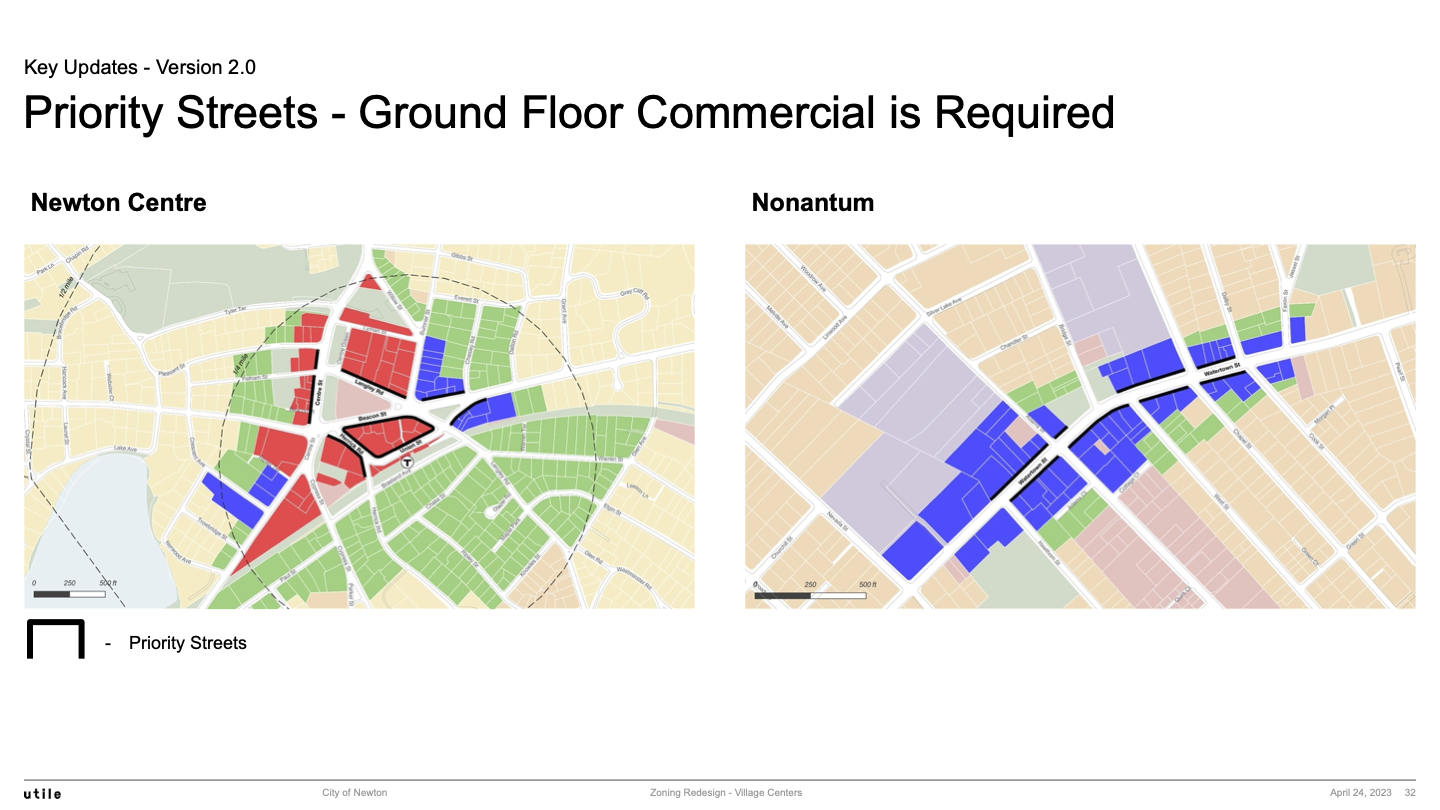
Note 3: Streets marked with solid lines are “Priority Streets” that require commercial spaces on the ground floor.
Note 4: We did not capture the map legend colors used in the interactive comparison tool since the tool only permits the user to see one set of colors at a time.
Visual Comparison of Village Center Zoning Maps 1.0 vs 2.0
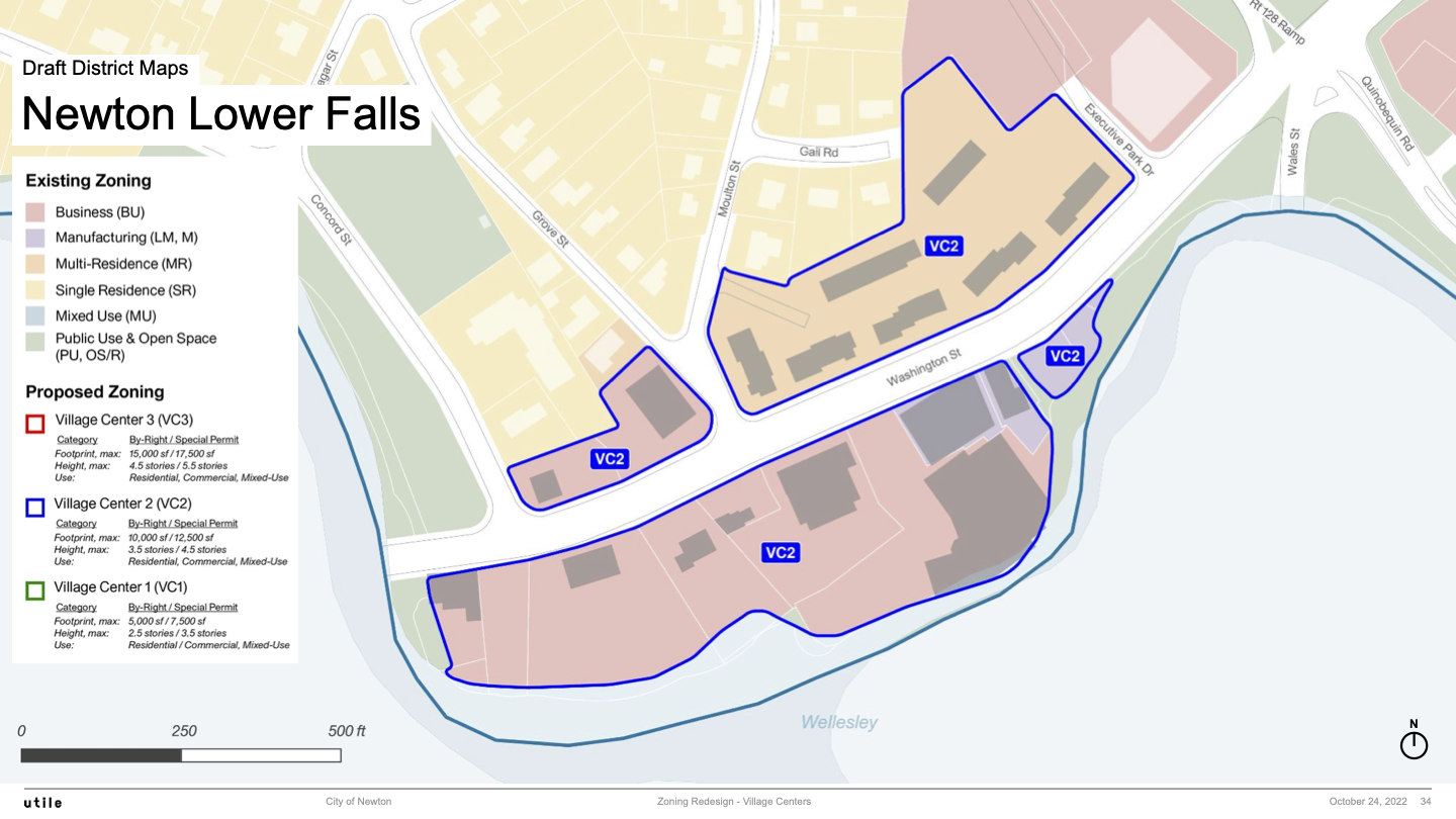
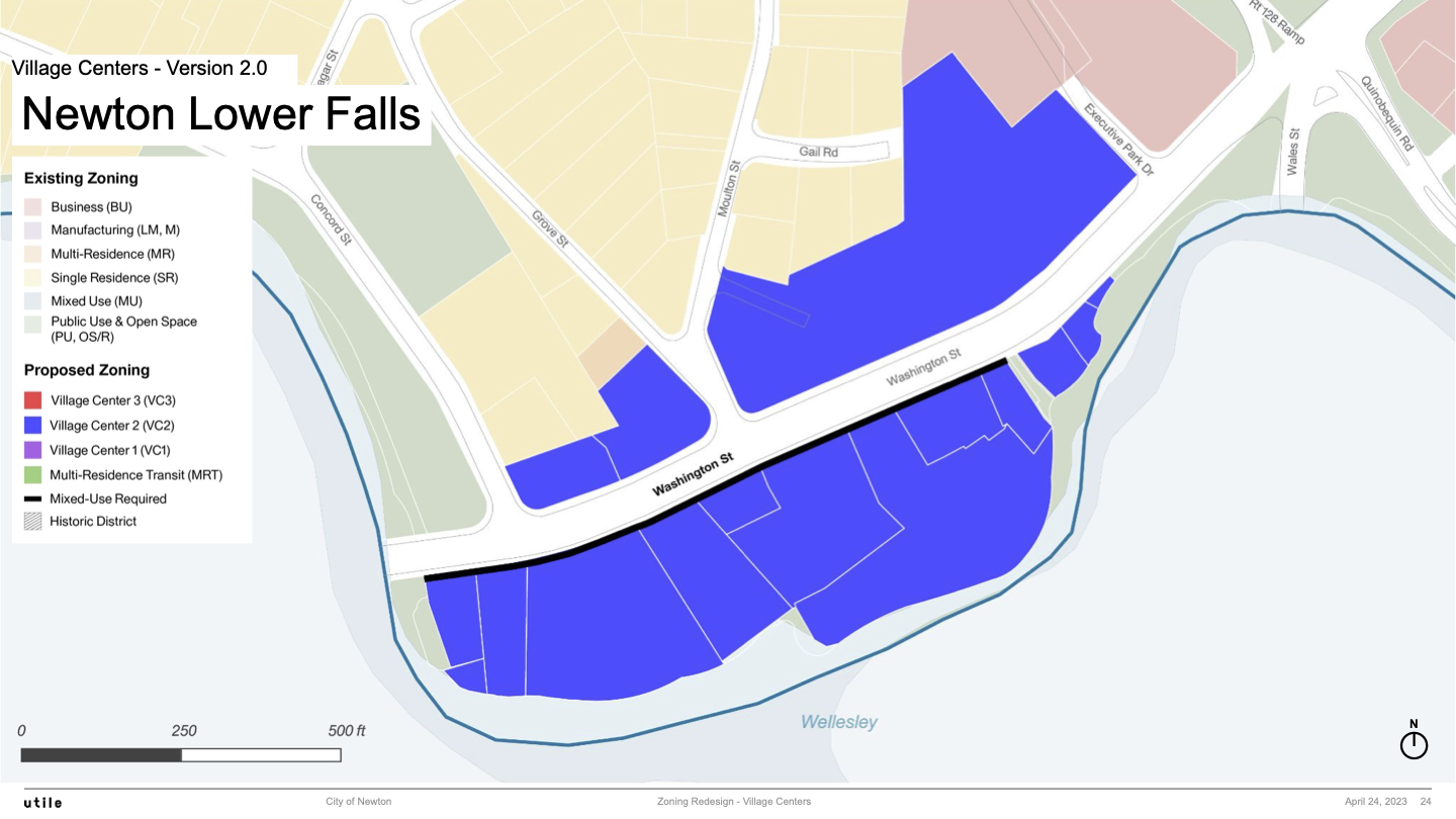
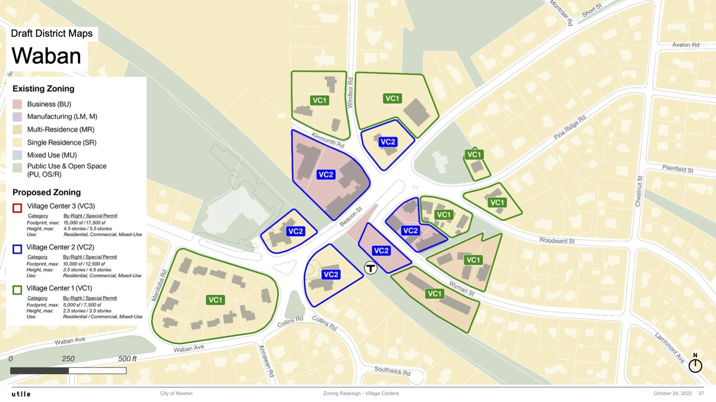
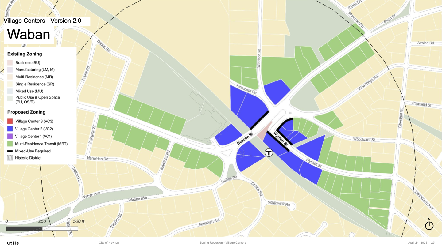
In this section, all maps come in pairs with a version 1.0 map above and a version 2.0 map below.
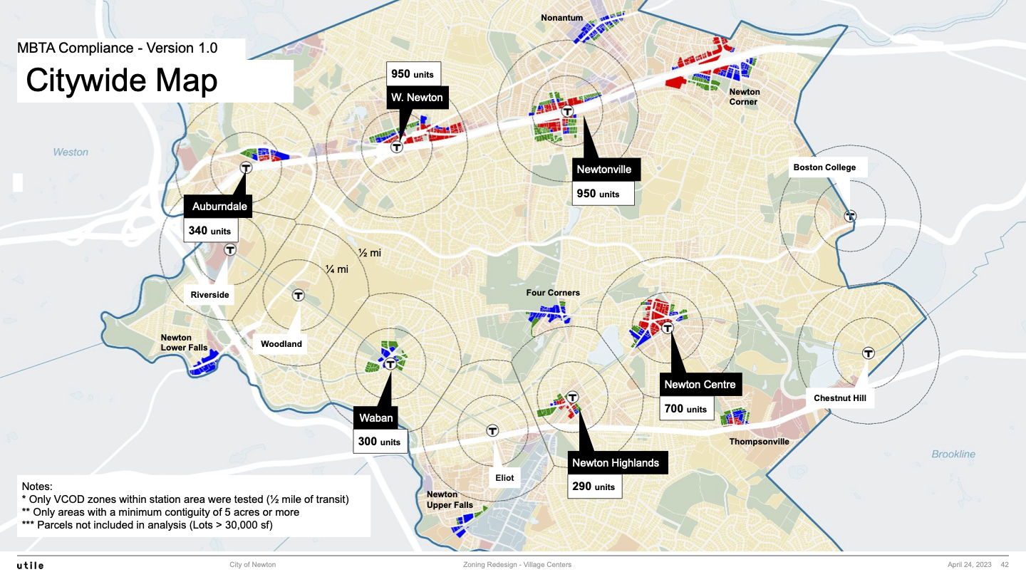
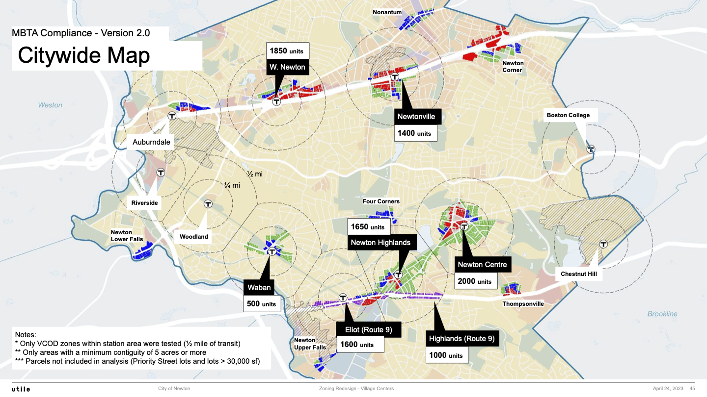
Citywide Maps
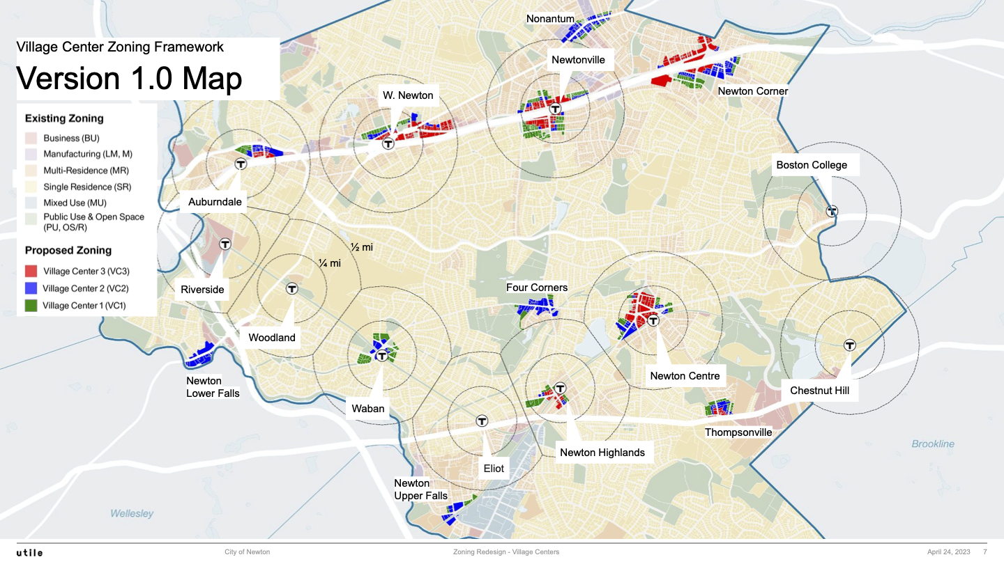
Version 1.0 Citywide Map
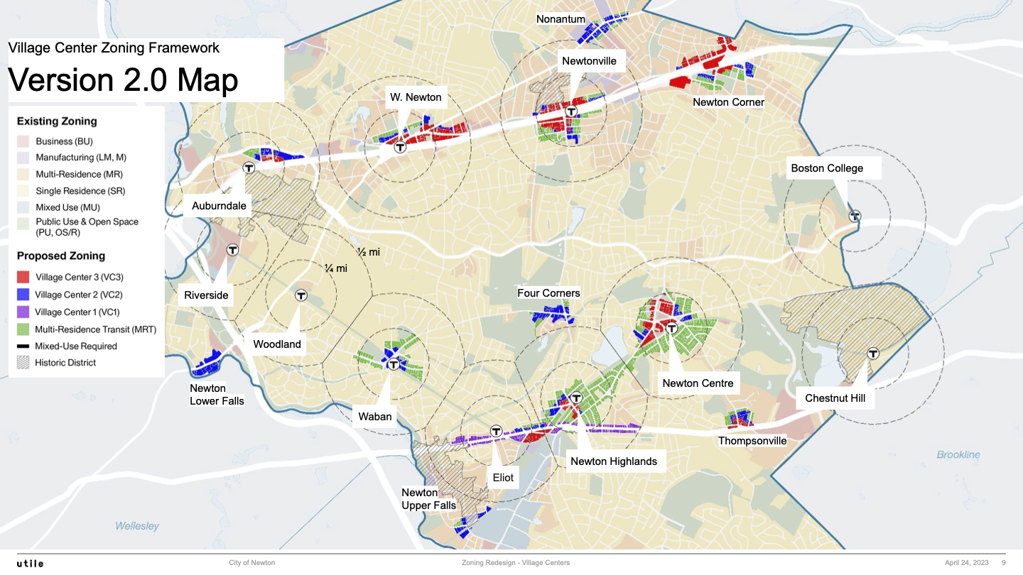
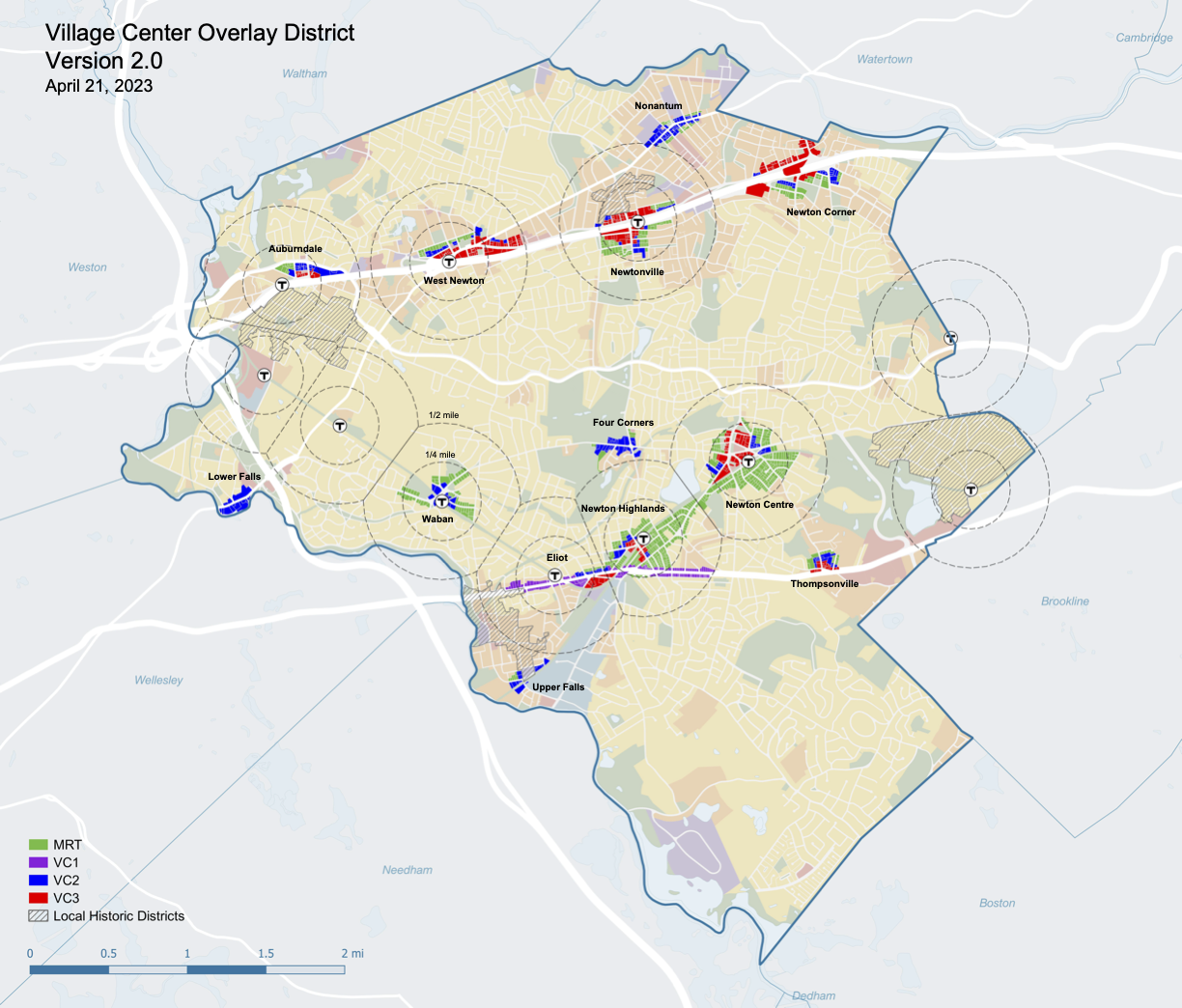
Version 2.0 Citywide Map
Version 2.0 Citywide Map with the entire city
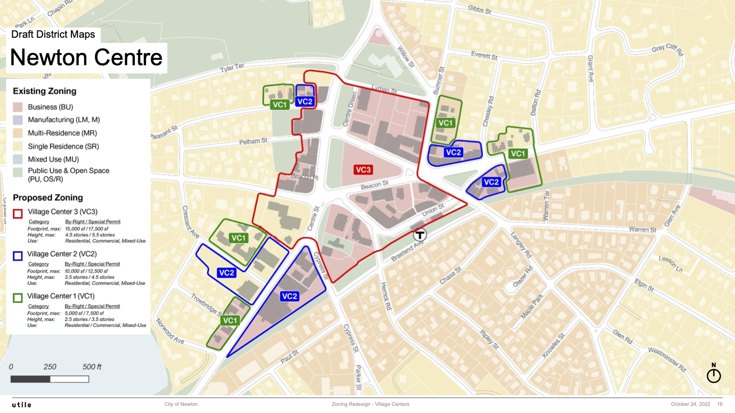
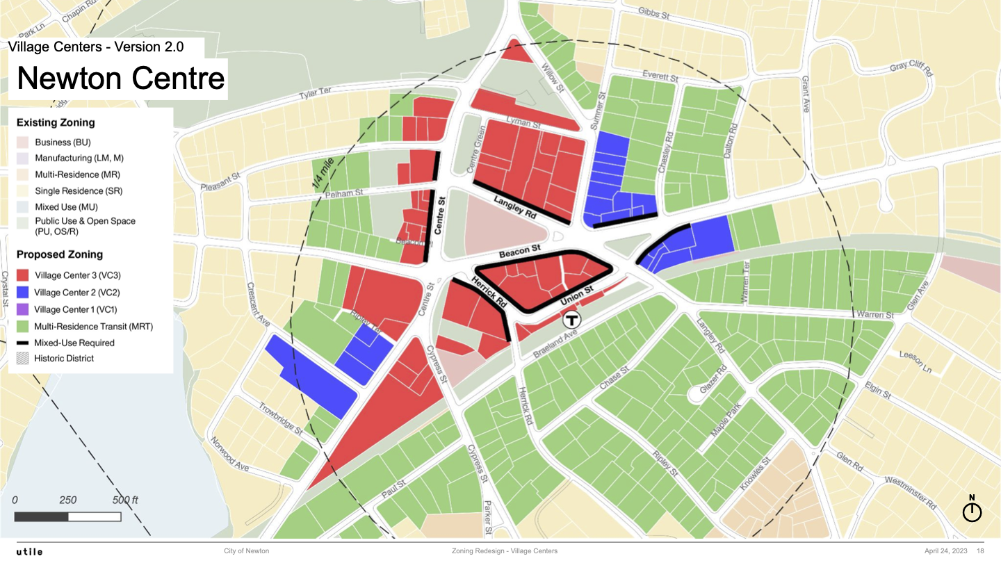
Newton Centre
Newton Centre 1.0 Map
Newton Centre 2.0 Map
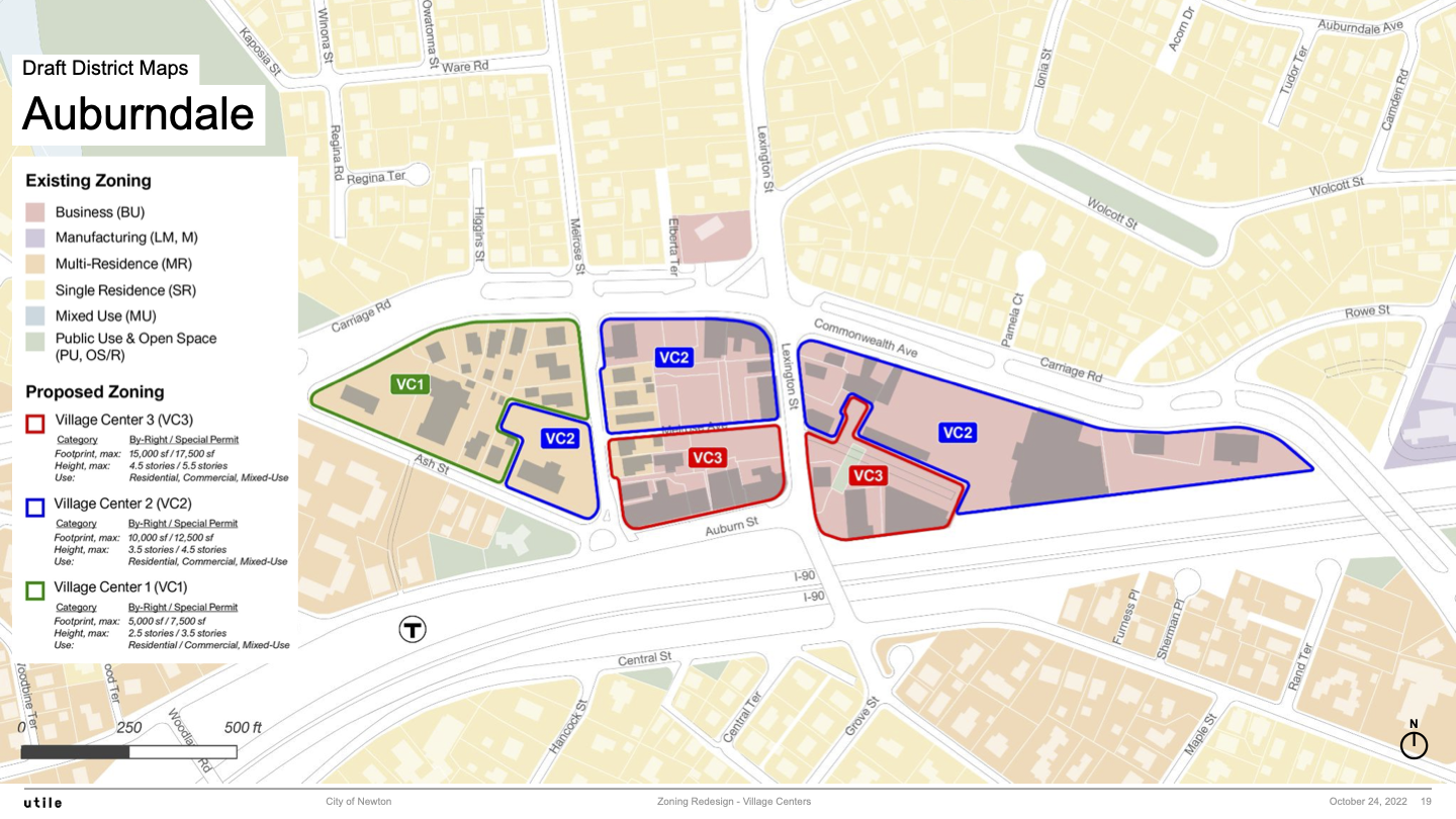
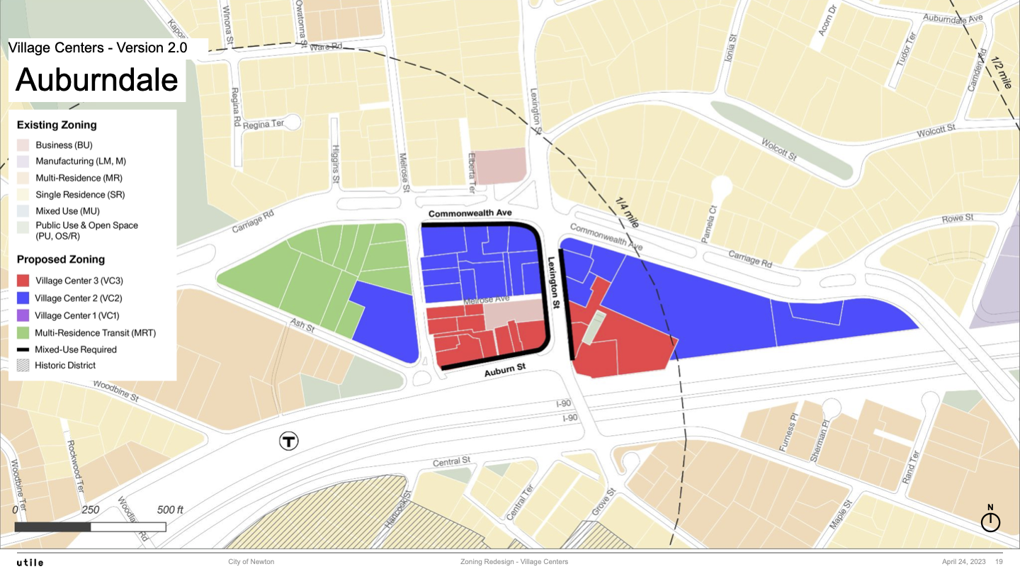
Auburndale
Auburndale 1.0 Map
Auburndale 2.0 Map
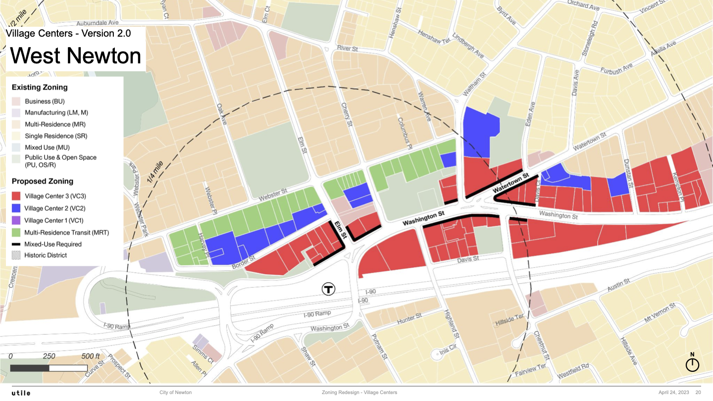
West Newton
West Newton 1.0 Map
West Newton 2.0 Map
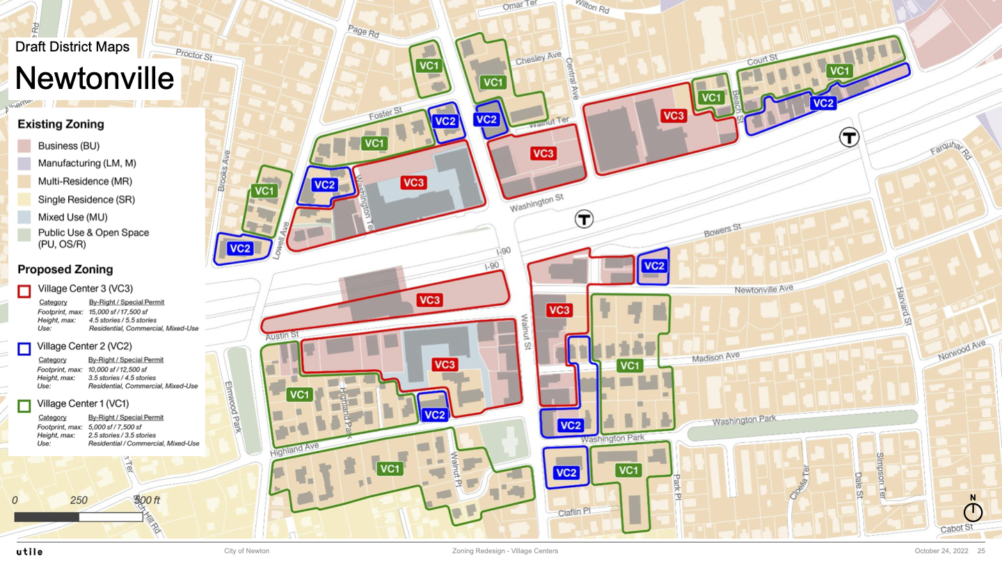
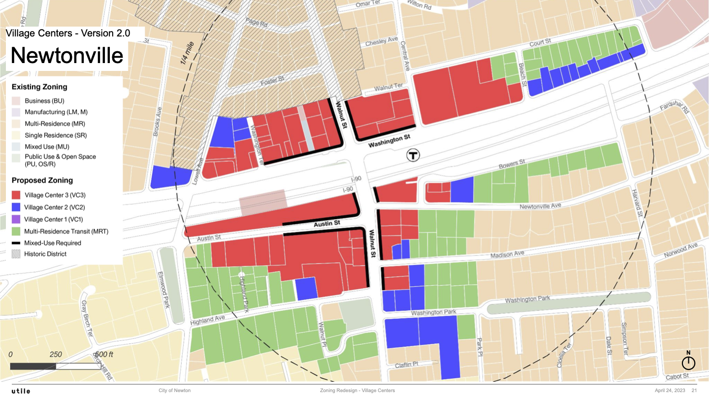
Newtonville
Newtonville 1.0 Map
Newtonville 2.0 Map
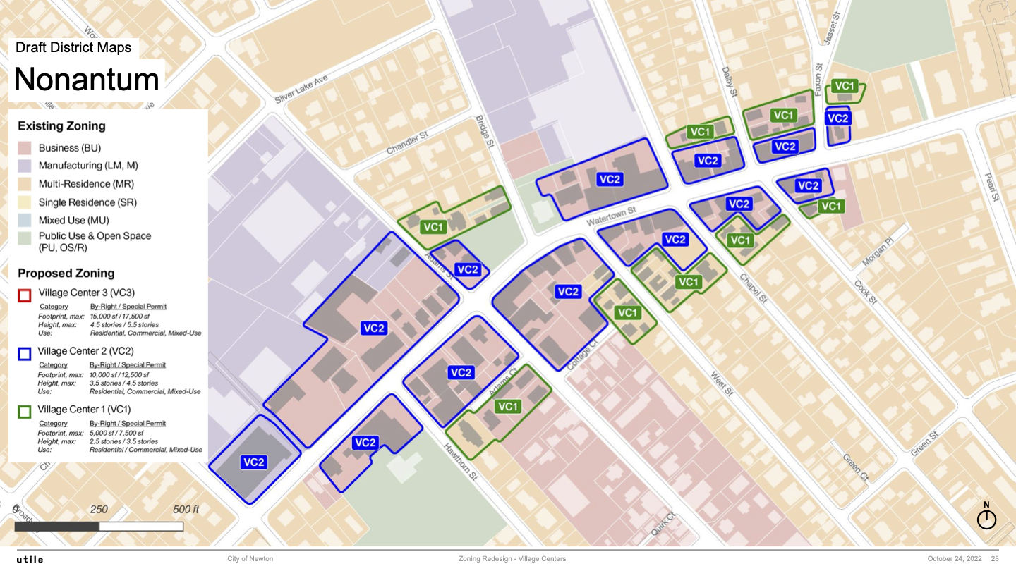
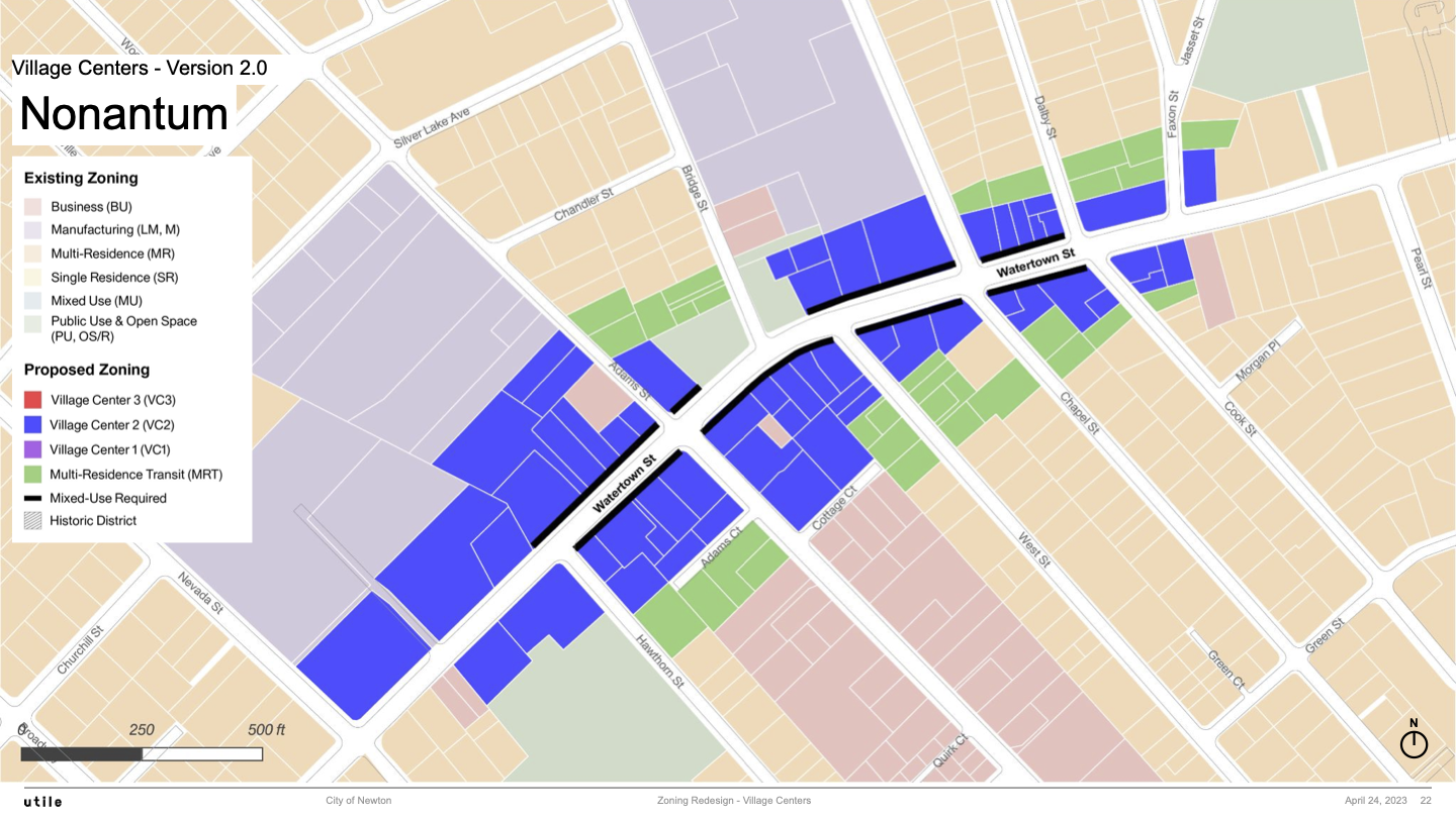
Nonantum
Nonantum 1.0 Map
Nonantum 2.0 Map
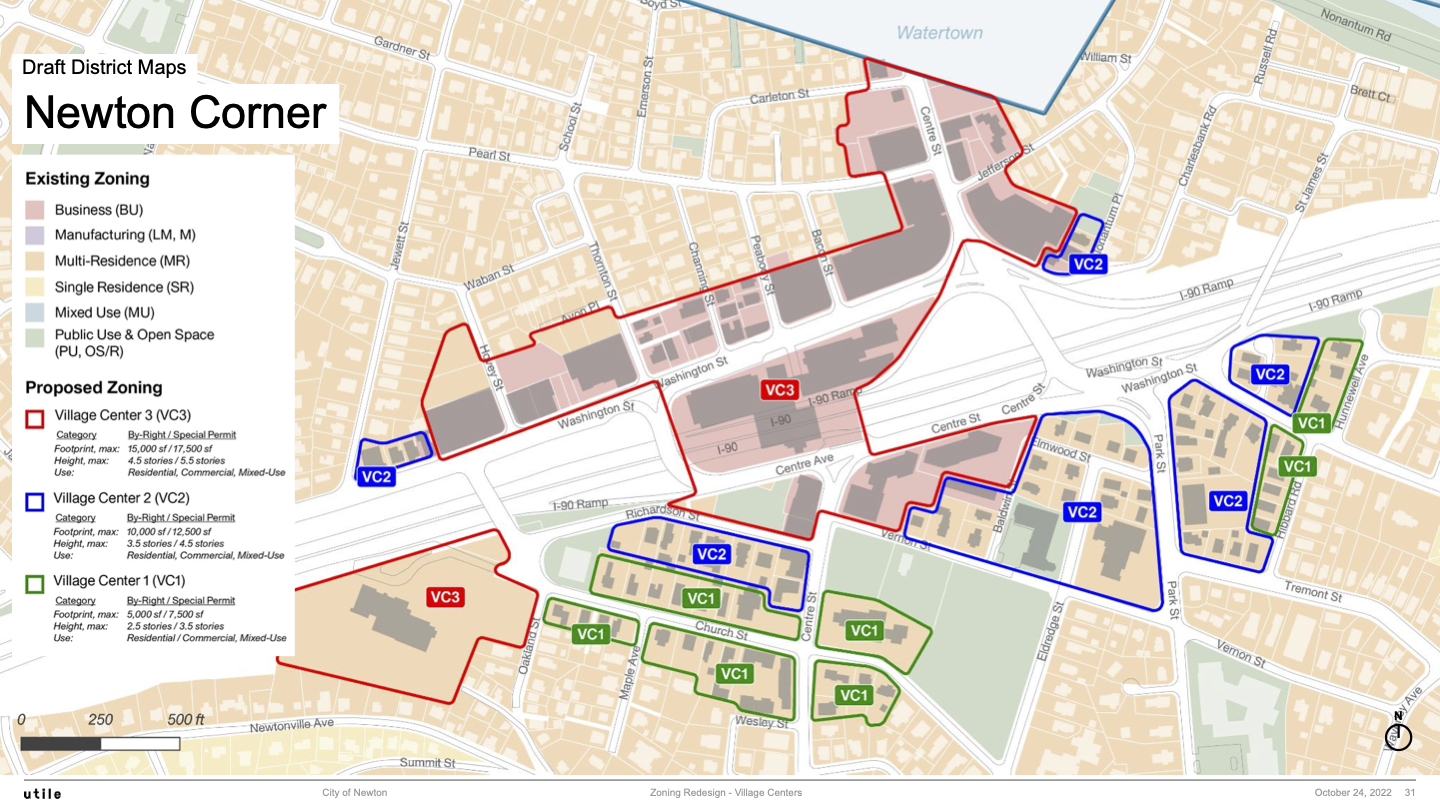
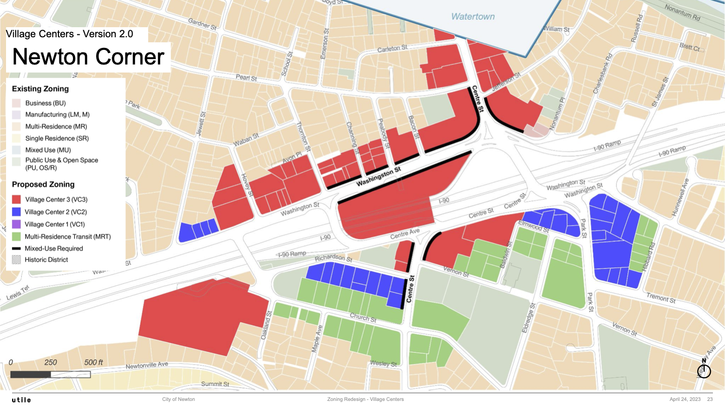
Newton Corner
Newton Corner 1.0 Map
Newton Corner 2.0 Map
Newton Lower Falls
Newton Lower Falls 1.0 Map
Newton Lower Falls 2.0 Map
Waban
Waban 1.0 Map
Waban 2.0 Map
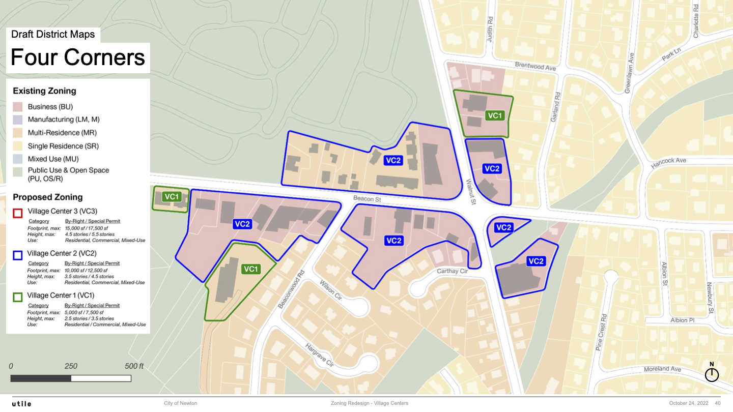
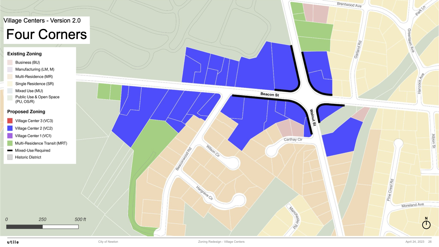
Four Corners
Four Corners 1.0 Map
Four Corners 2.0 Map
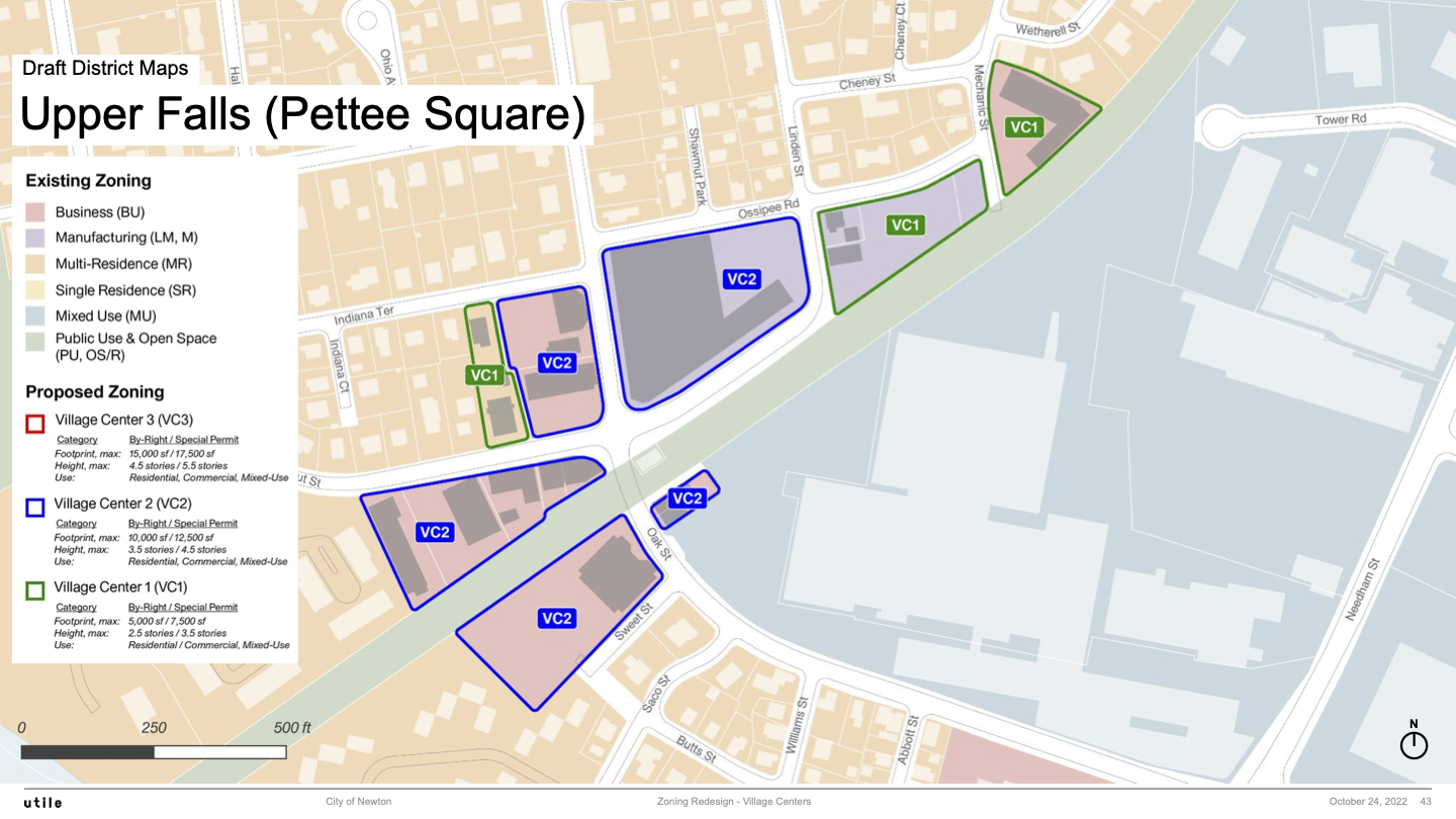
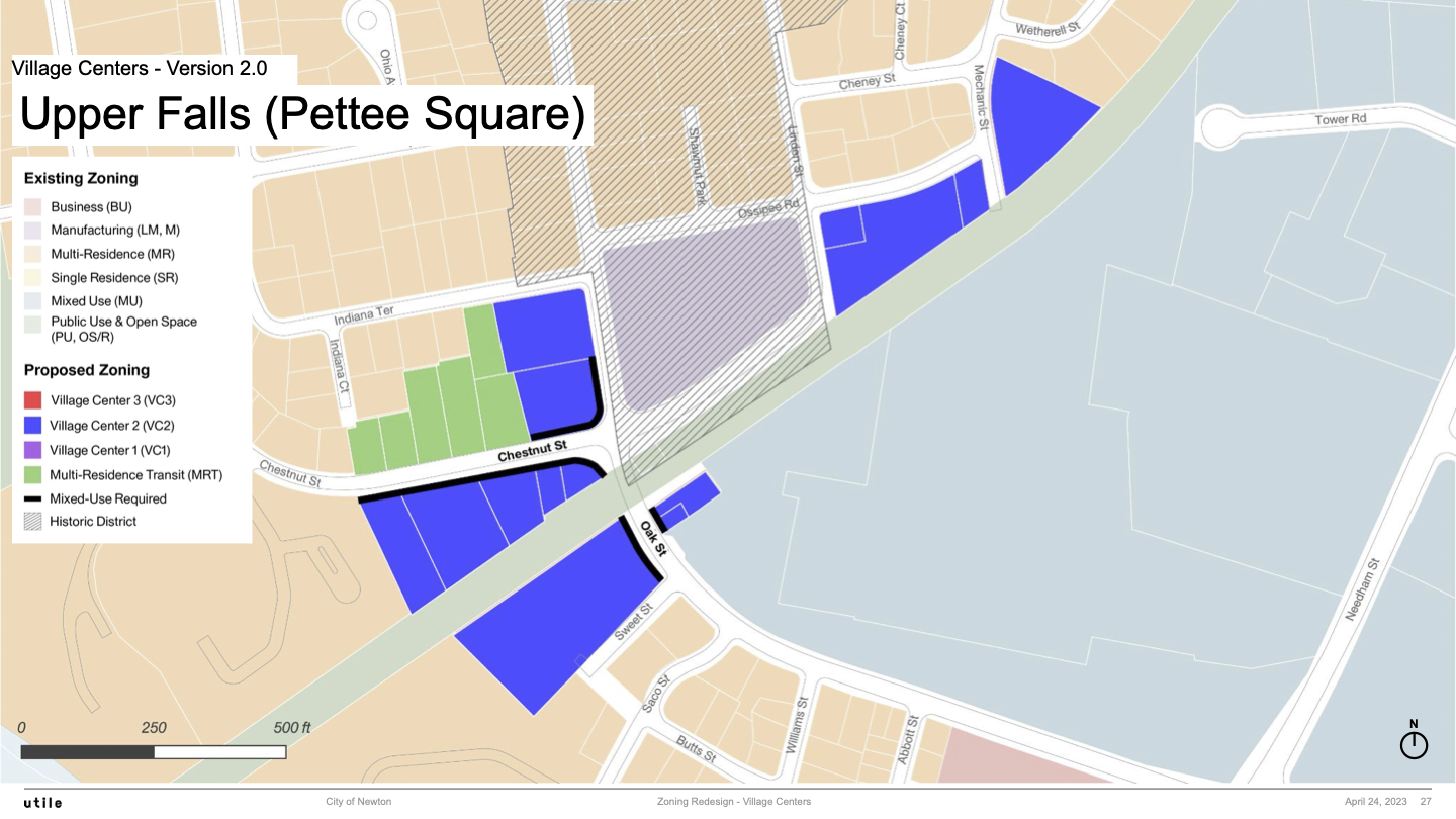
Newton Upper Falls
Newton Upper Falls 1.0 Map
Newton Upper Falls 2.0 Map
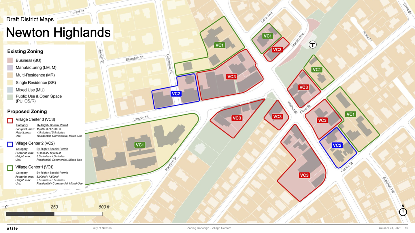
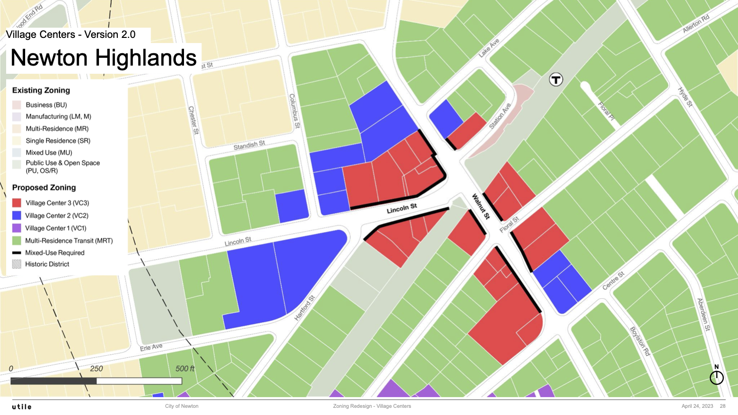
Newton Highlands
Newton Highlands 1.0 Map
Newton Highlands 2.0 Map
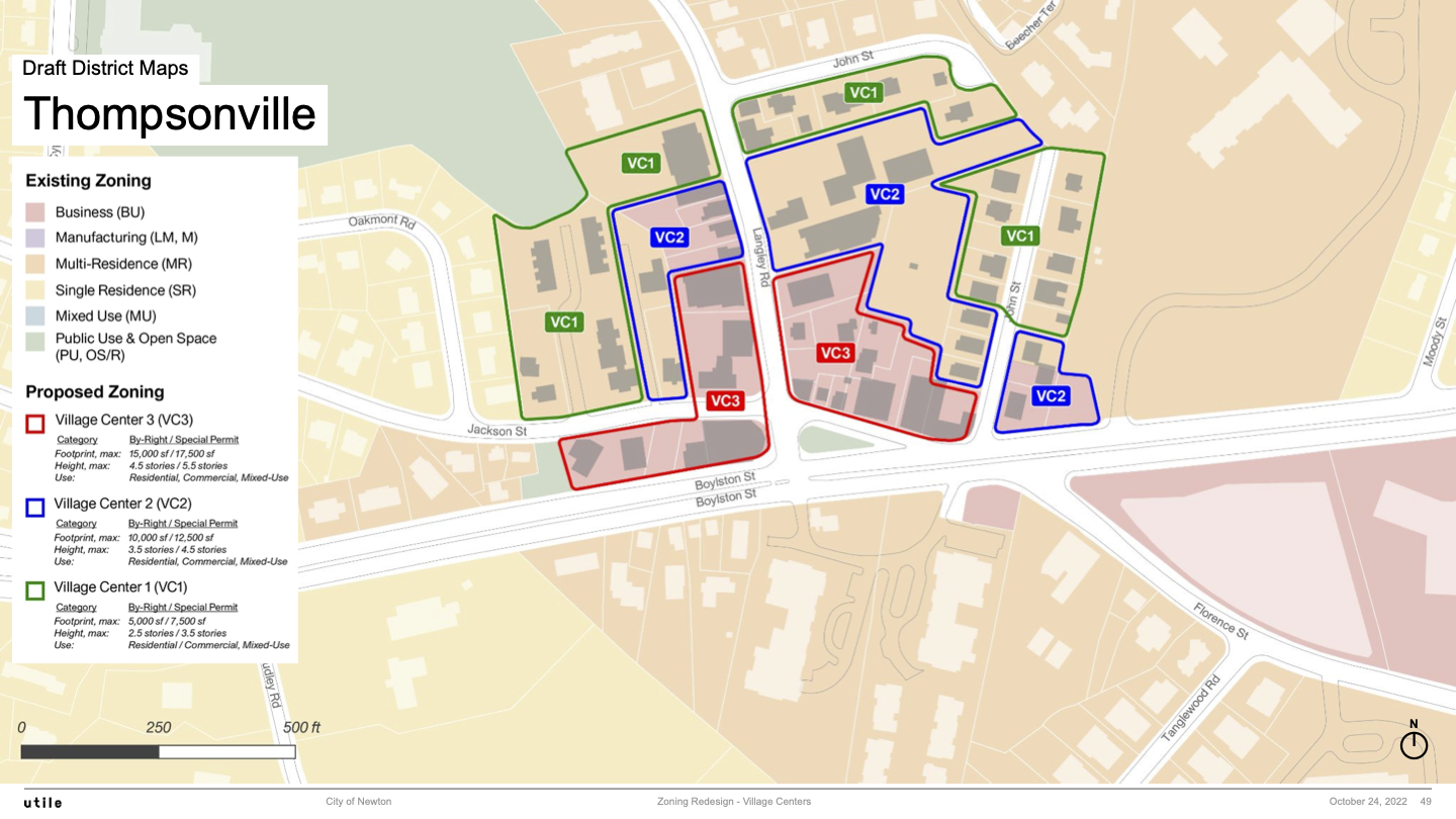
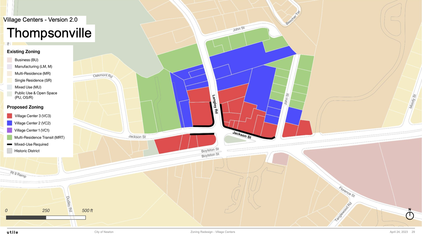
Thompsonville
Thompsonville 1.0 Map
Thompsonville 2.0 Map
Zoning Specs for Version 2.0
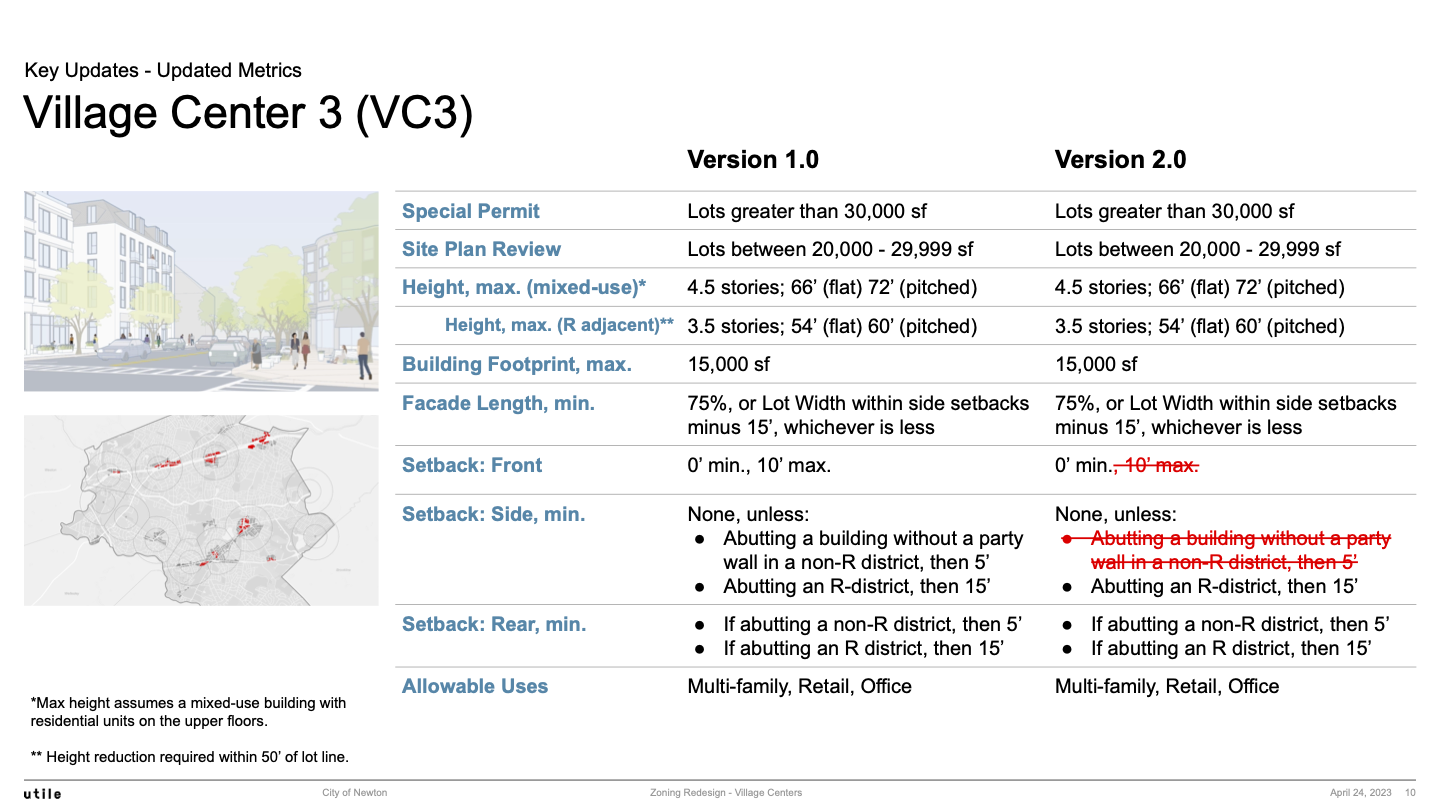
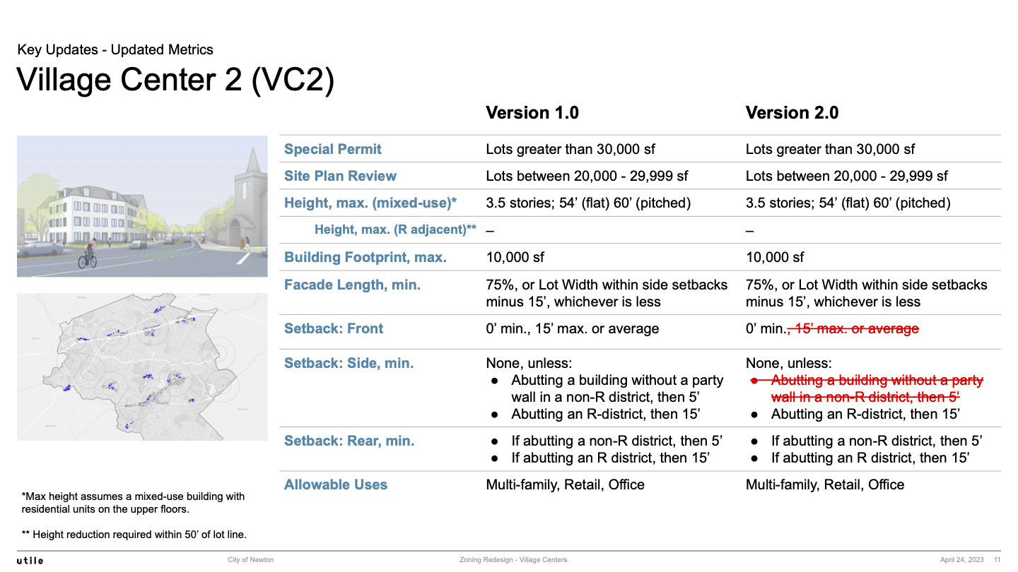
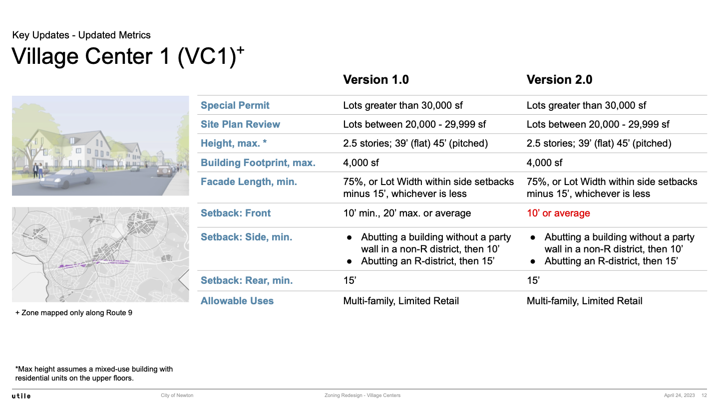
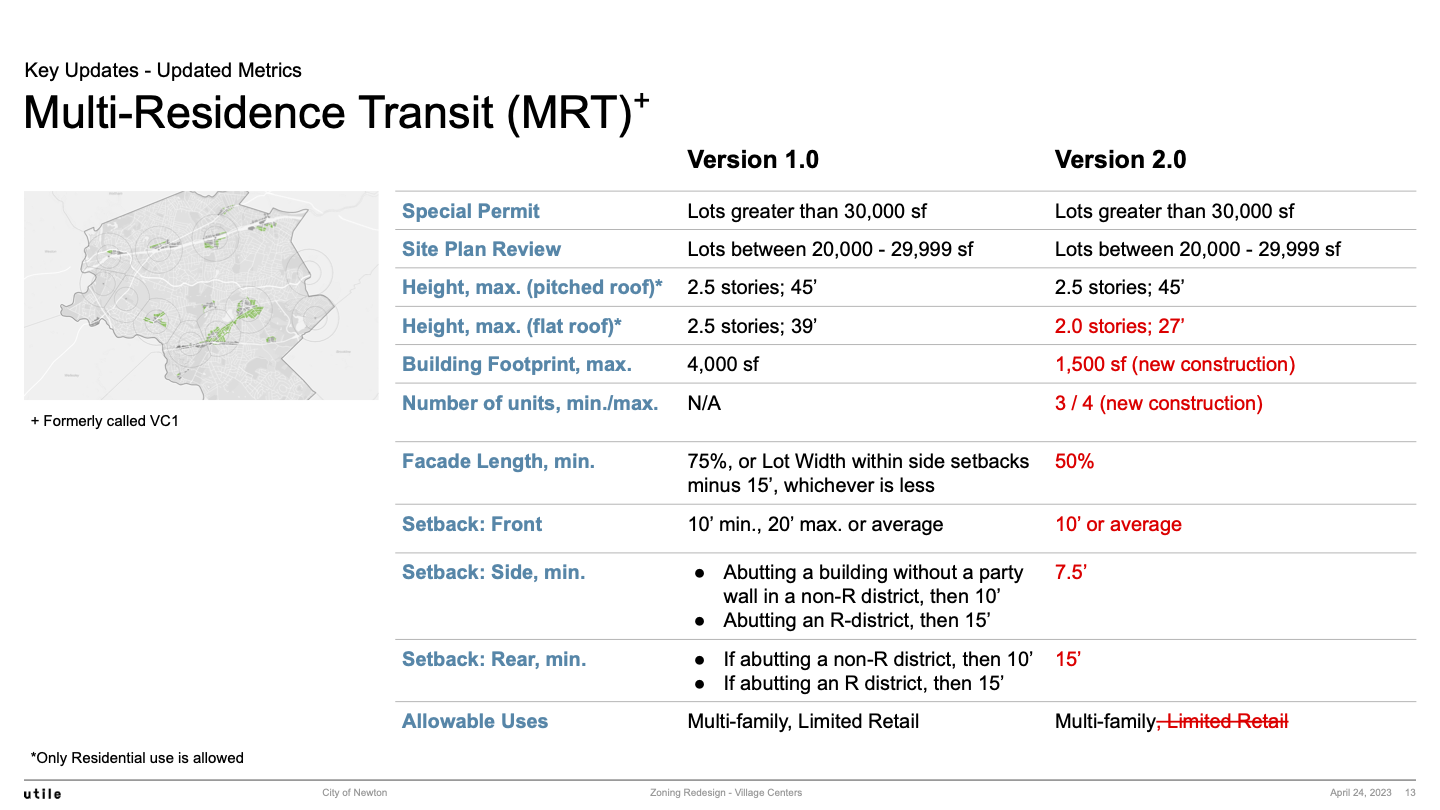
This section presents the main zoning specs for the zones VC3, VC2, and VC1 that were present in Version 1.0 plus the new zone MRT that is introduced in Version 2.0.
This section then presents 4 slides on new rules:
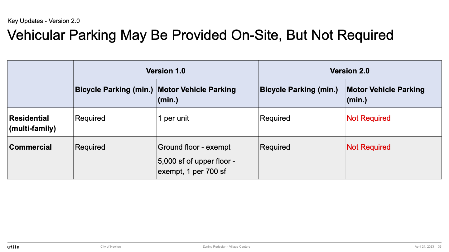
- No Required Minimum Parking
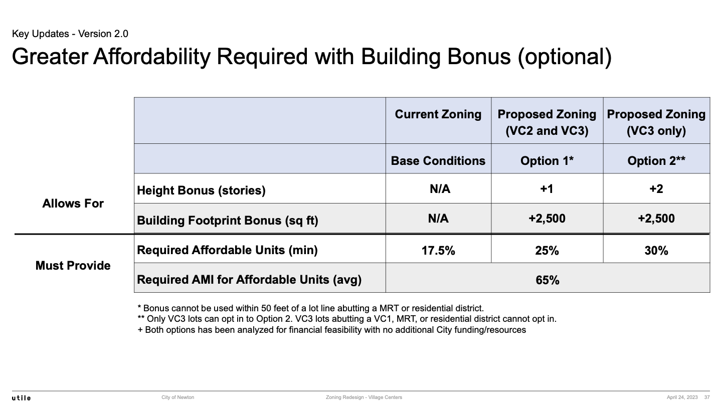
- Building Height Bonus in VC2 and VC3 - For Affordable Housing
- Priority Streets in VC2 and VC3 - Ground Floor Commercial Required
- VC1 - Restricted to a Route 9 Corridor
Village Center 3 (VC3)
Village Center 2 (VC2)
Village Center 1 (VC1)
Multi-Residence Transit (MRT)
No Required Minimum Parking
Building Height Bonus in VC2 and VC3 - For Affordable Housing
Priority Streets in VC2 and VC3 - Ground Floor Commercial Required
VC1 - Restricted to a Route 9 Corridor
MBTA Communities Zoning and Maps
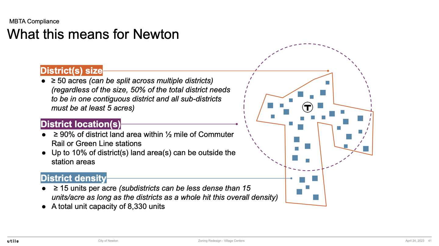
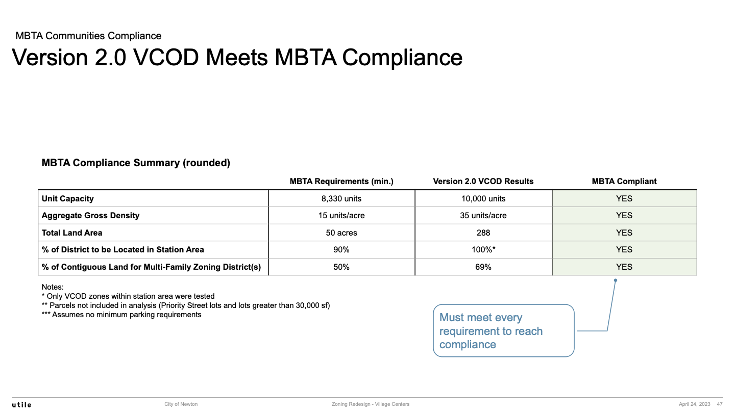
This section describes the MBTA Communities Law requirements for Newton, then shows various maps that illustrate the proposed approach to satisfying these requirements, and then concludes that the proposed approach will meet the MBTA requirements.
MBTA Communities Requirements for Newton
MBTA Citywide Maps
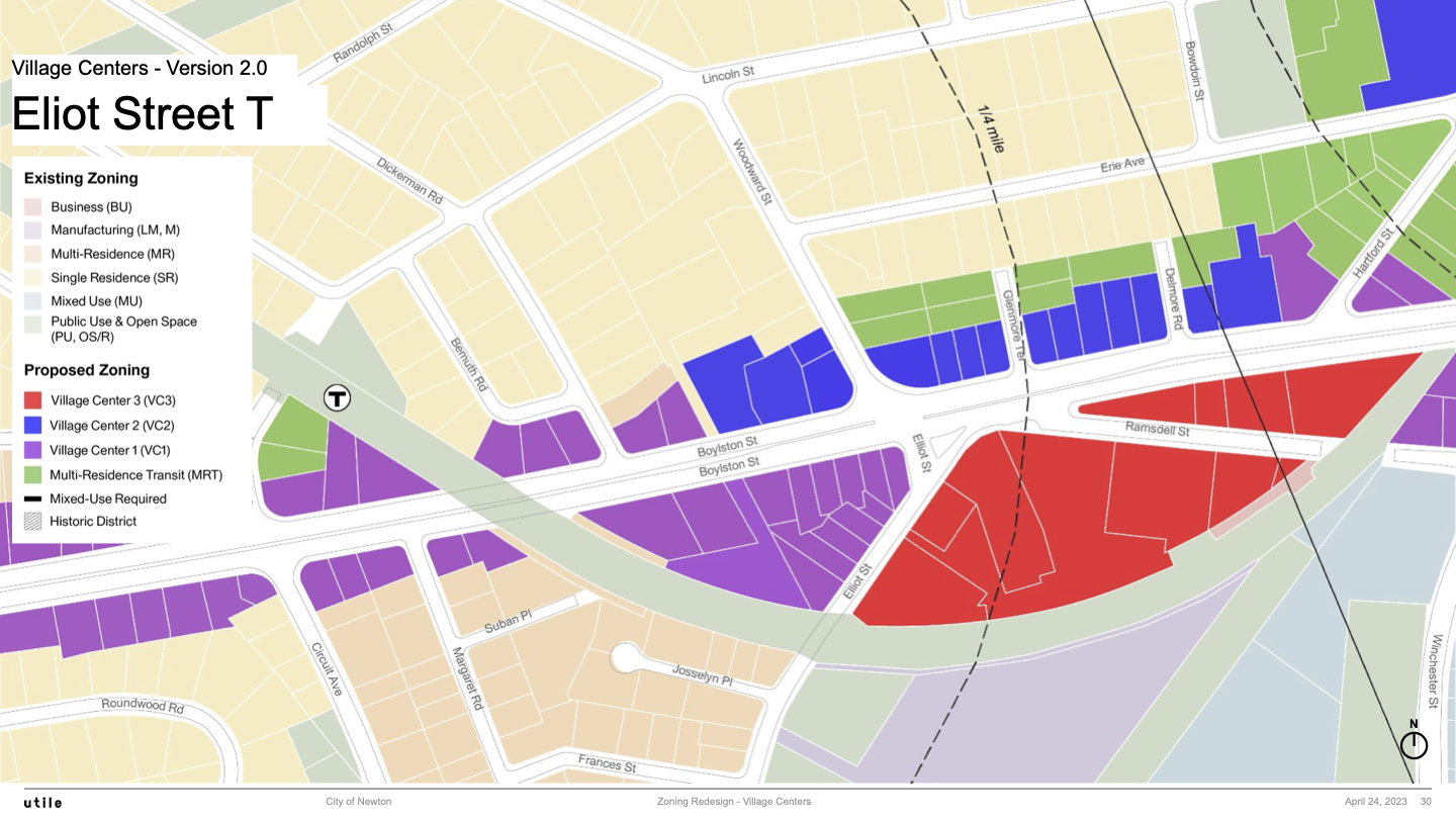
Eliot T Area Map
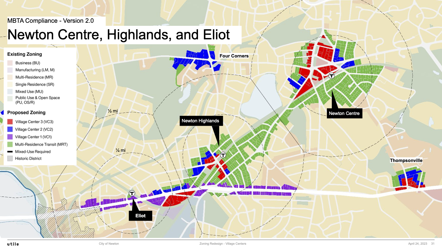
Newton Centre, Newton Highlands, Eliot Map
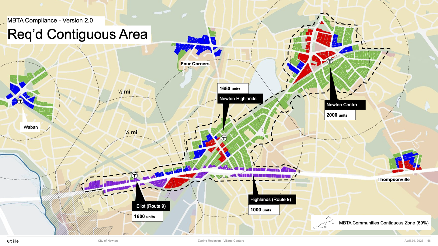
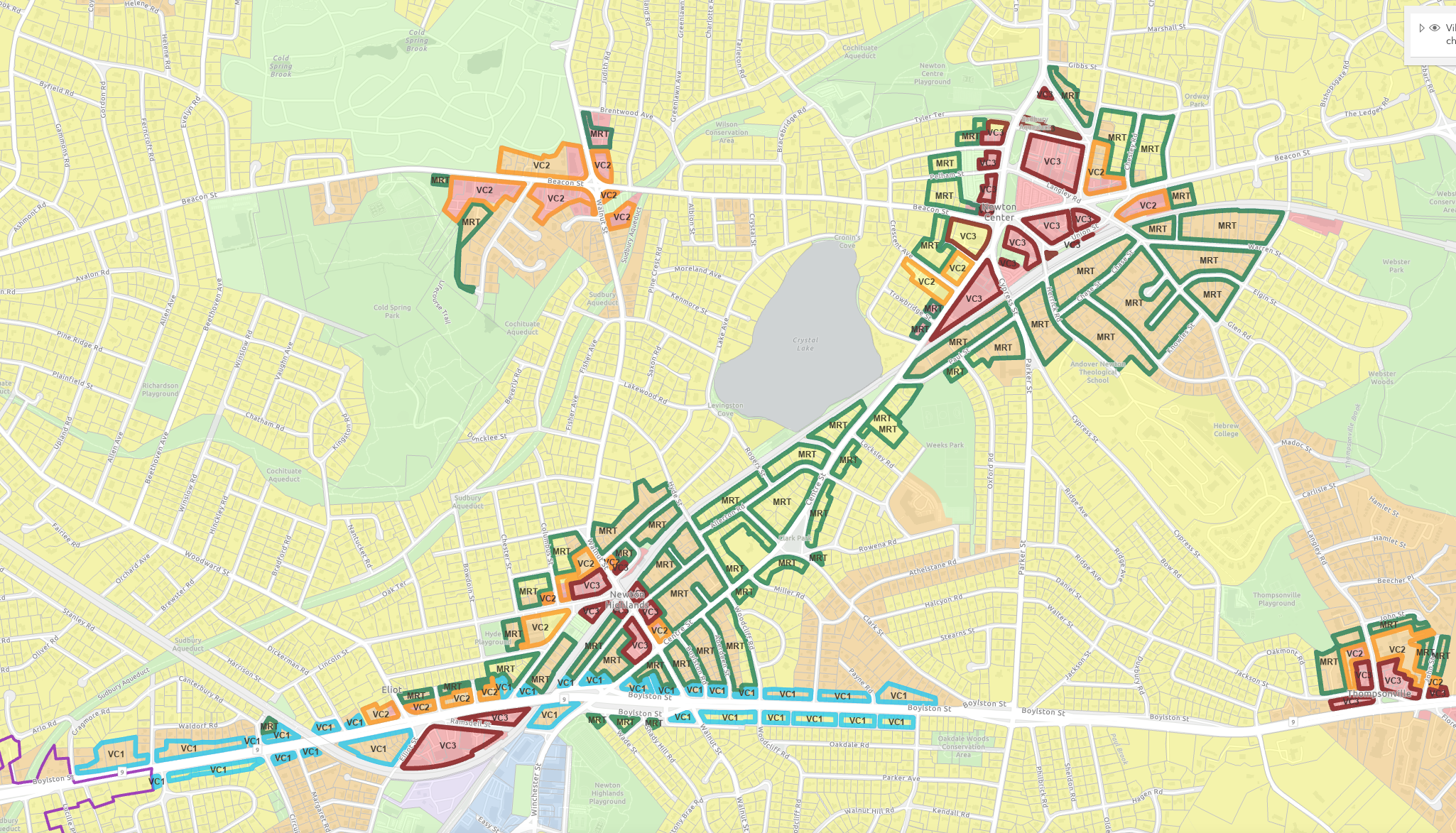
MBTA Required Contiguous Area Map {Multiple Versions}
MBTA Required Contiguous Area Map {from the 2023-04-24 slides}
MBTA Required Contiguous Area Map {via Interactive Comparion site}
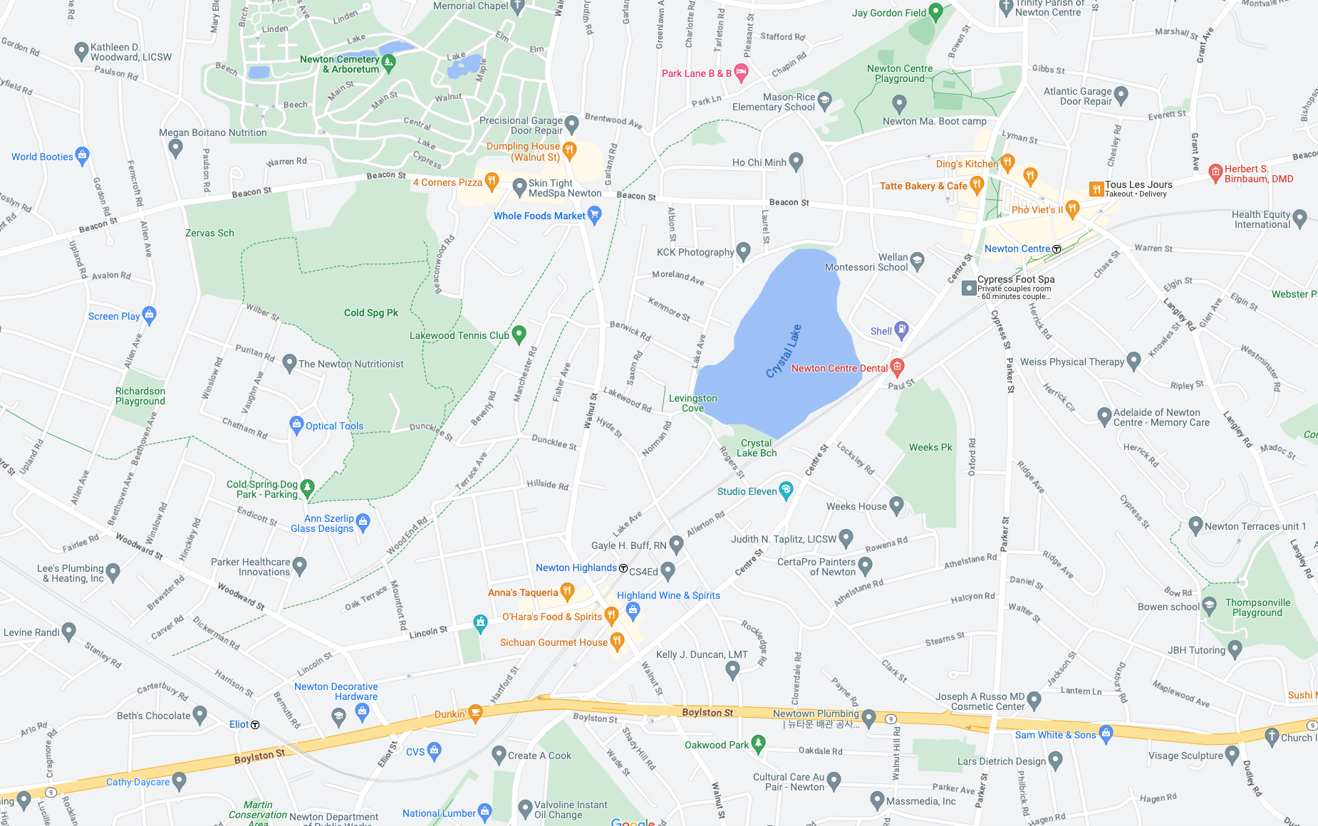
Google Street Map snaphot that includes the MBTA Contiguous Area
Live Google map that is centered at the same location as the snaphot area above:
Version 2 Meets MBTA Compliance
Appendix: Some Additional Slides from the Presentation of April 24 2023
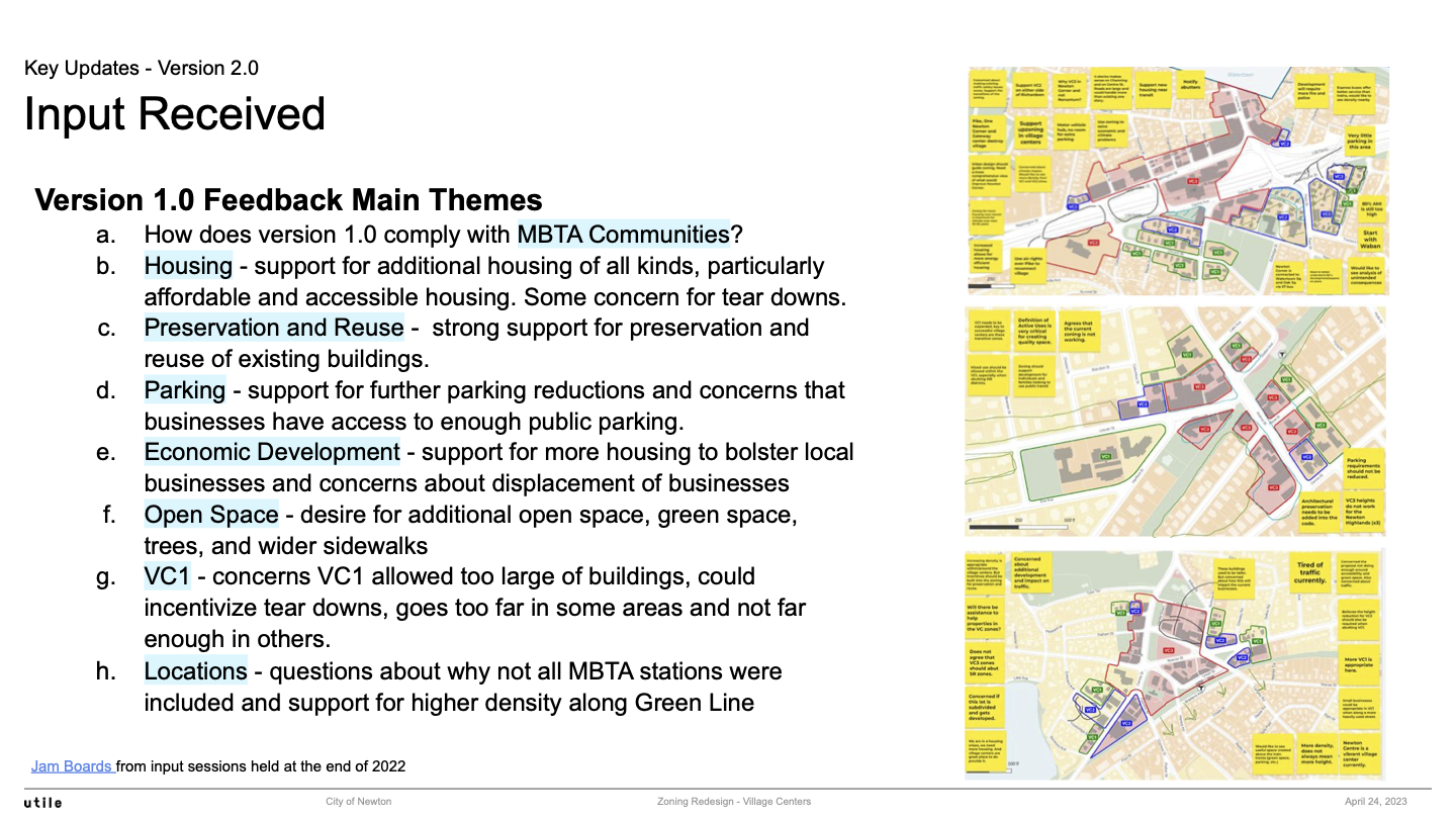
Community Input Received
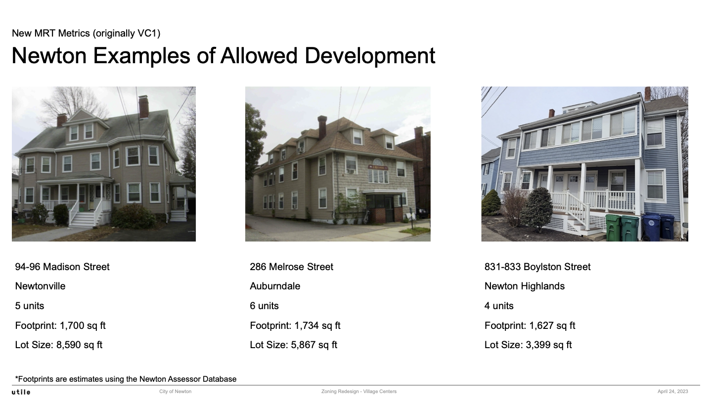
MRT: Newton Examples of Allowed Development #1
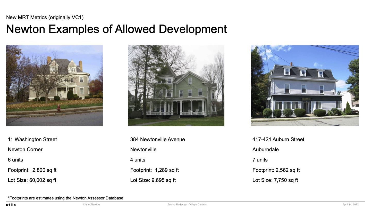
MRT: Newton Examples of Allowed Development #2
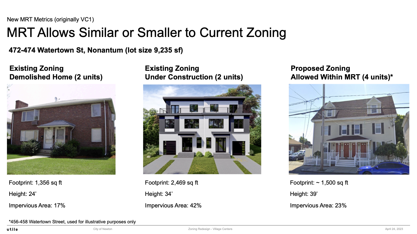
MRT Allows Similar or Smaller to Current Zoning
Appendix: Half Mile Circle Maps at Rapid Transit & Commuter Rail T Stops
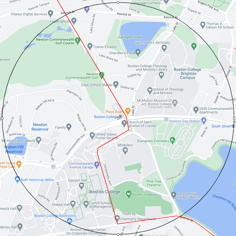
Green Line B: Boston College
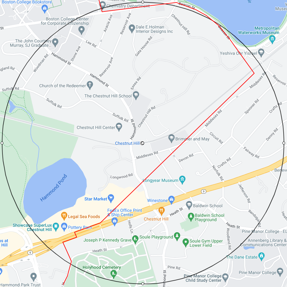
Green Line D: Chestnut Hill T
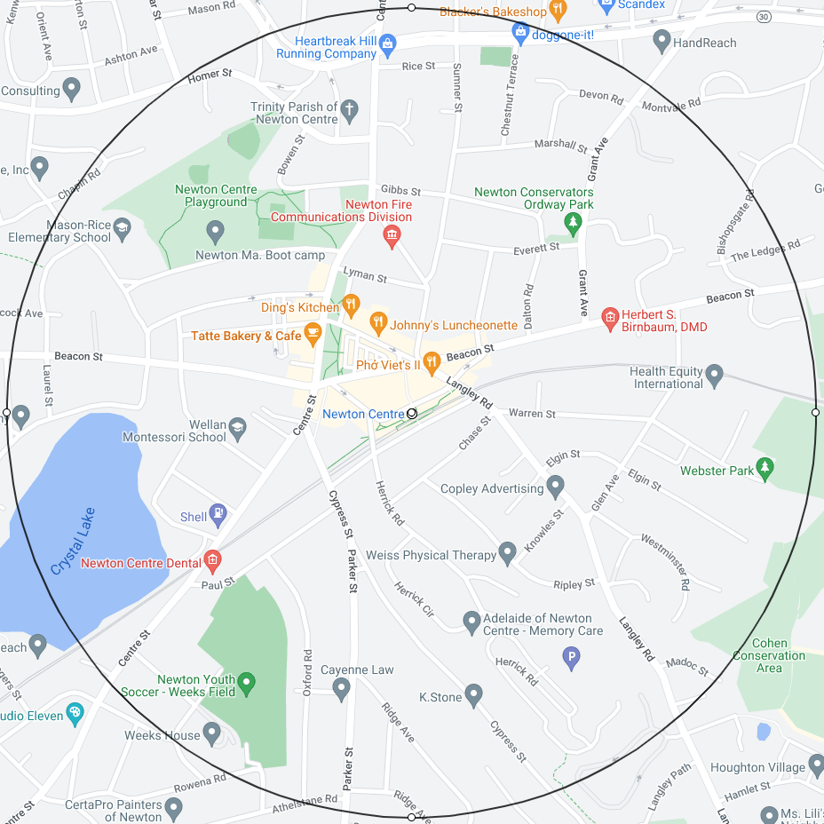
Green Line D: Newton Centre T
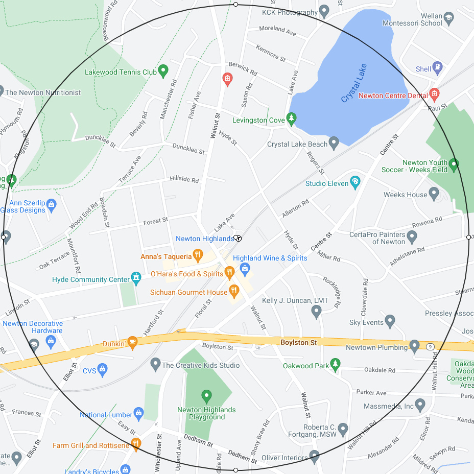
Green Line D: Newton Highlands T
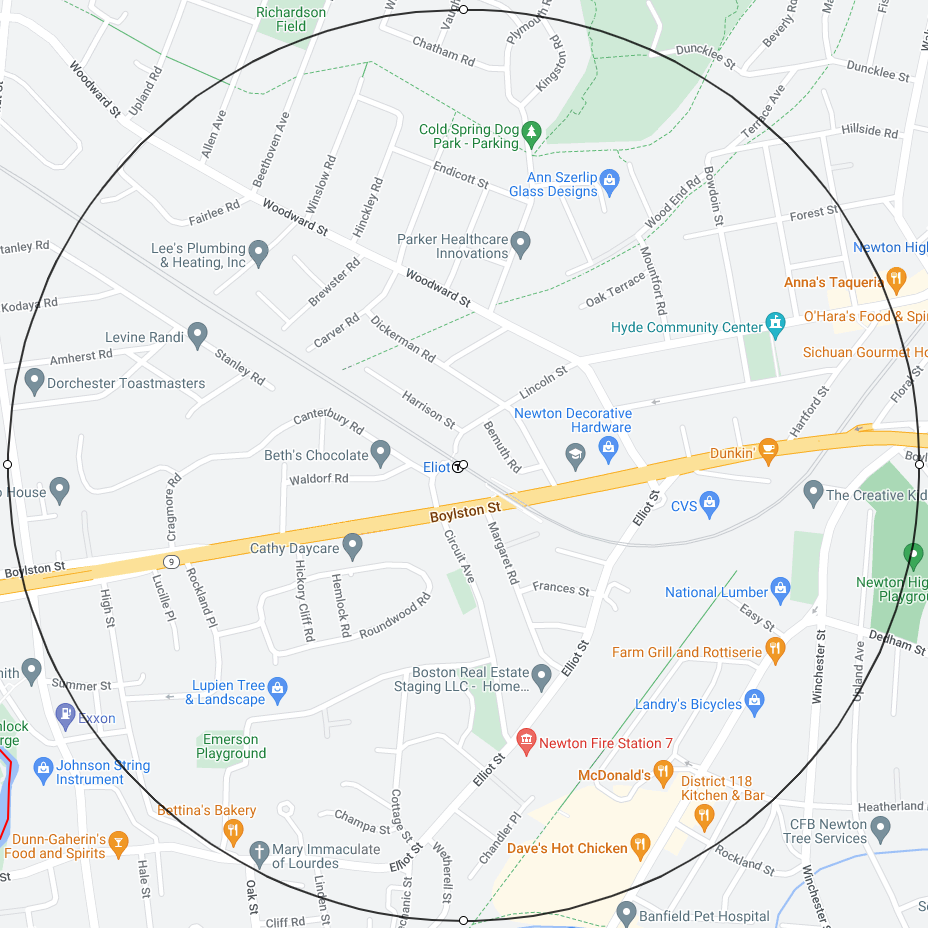
Green Line D: Eliot T
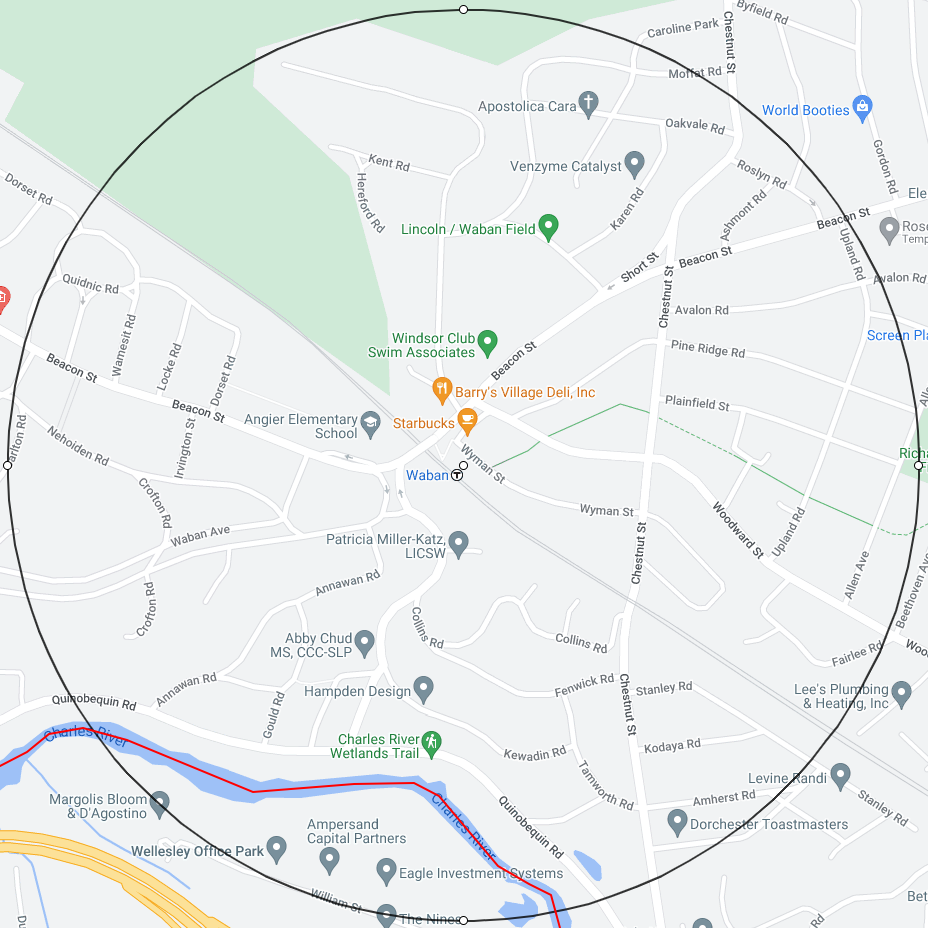
Green Line D: Waban T
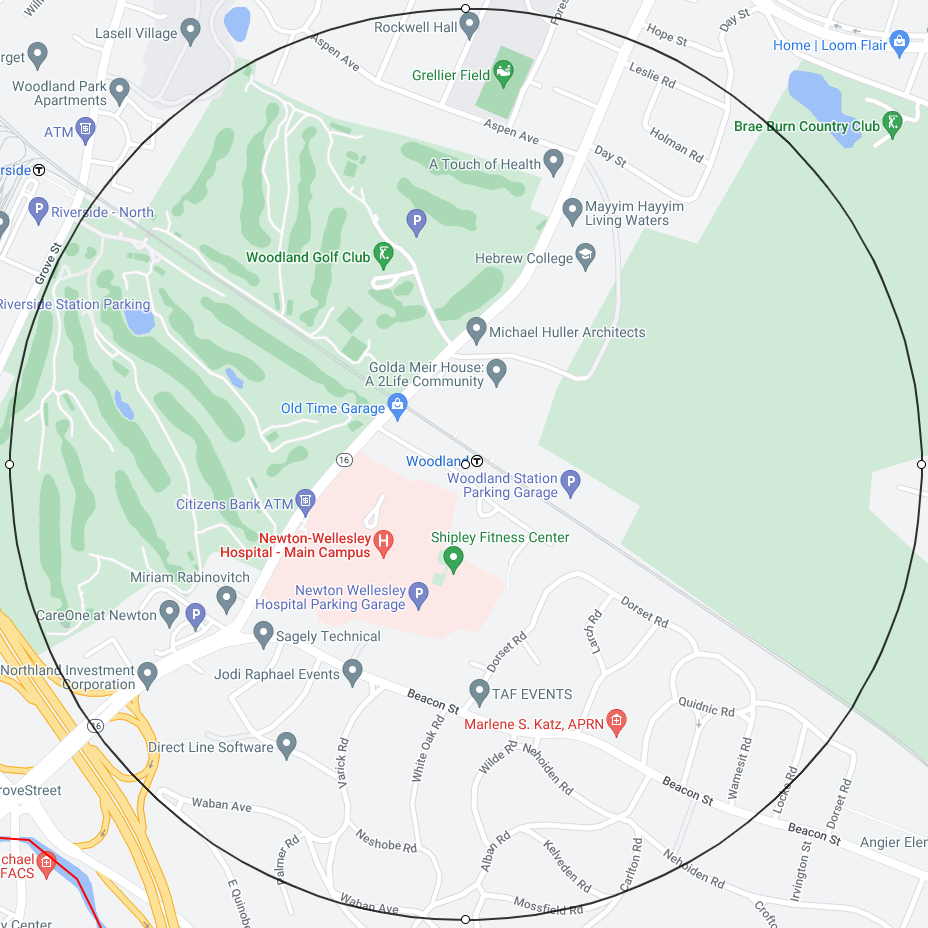
Green Line D: Woodland T
Green Line D: Riverside T
Commuter Rail: Newtonville T
Commuter Rail: West Newton T
Commuter Rail: Auburndale T
Newton Map with 11 Half Mile Circles
